Read The
Current Issue

Beyond the Tetons
The Wind River Mountains are home to the state’s highest peak, biggest and largest number of glaciers, and hundreds of miles of trails. They’re a two-hour drive from Jackson, and worth the trip.
BY Dina Mishev
MY FIRST HIKE in the Wind River Mountains, the biggest range in Wyoming—and home to the state’s highest peak (Gannett), about twenty-five named glaciers, and three wilderness areas—was a spectacular failure. And I fell in love with these mountains because of it. They are wild and big, and you can go days without seeing people if you want. There are more than forty named peaks over 13,000 feet in the Winds and more than one hundred unnamed glaciers. In the Teton Range, there are exactly five lakes over 10,000 feet in elevation. If you pick your section of trail carefully, you can pass five lakes over 10,000 feet in one mile in the Winds. On maps, about half of the range’s lakes are described merely by their elevations rather than given names since there are so many.
And then there’s the range’s abundance of open, high alpine terrain. You can walk for miles and miles and miles in grassy meadows at 10,000 feet. Here, 10,000 feet is mostly above tree line, but you’ll find just enough stands of scraggly and ancient whitebark pine to hang your food away from animals when you make camp at night. (Grizzly and black bears, marmots, picas, and coyotes—among other animals that would love to eat your dinner—live in the range.)
Partly because of these high alpine meadows, and partly because the Winds are roughly the size of the entire state of Delaware, trails here are highly variable. In popular areas like Big Sandy, Cirque of the Towers, Elkhart Park, and Titcomb Basin you can trust trail maps: If there is a trail on a map, it will be there in reality. But venture away from these well-traveled spots and a trail on a map does not mean a trail in reality. Maybe there’s cairns instead of a trail. Or maybe there’s nothing at all.
Or maybe—like what happened to me about four miles into my spectacularly botched first attempt at backpacking in the range—a trail just fades away. At the time, this confused and terrified me. Never before had I hiked without a trail to guide me. Could you hike without a trail?
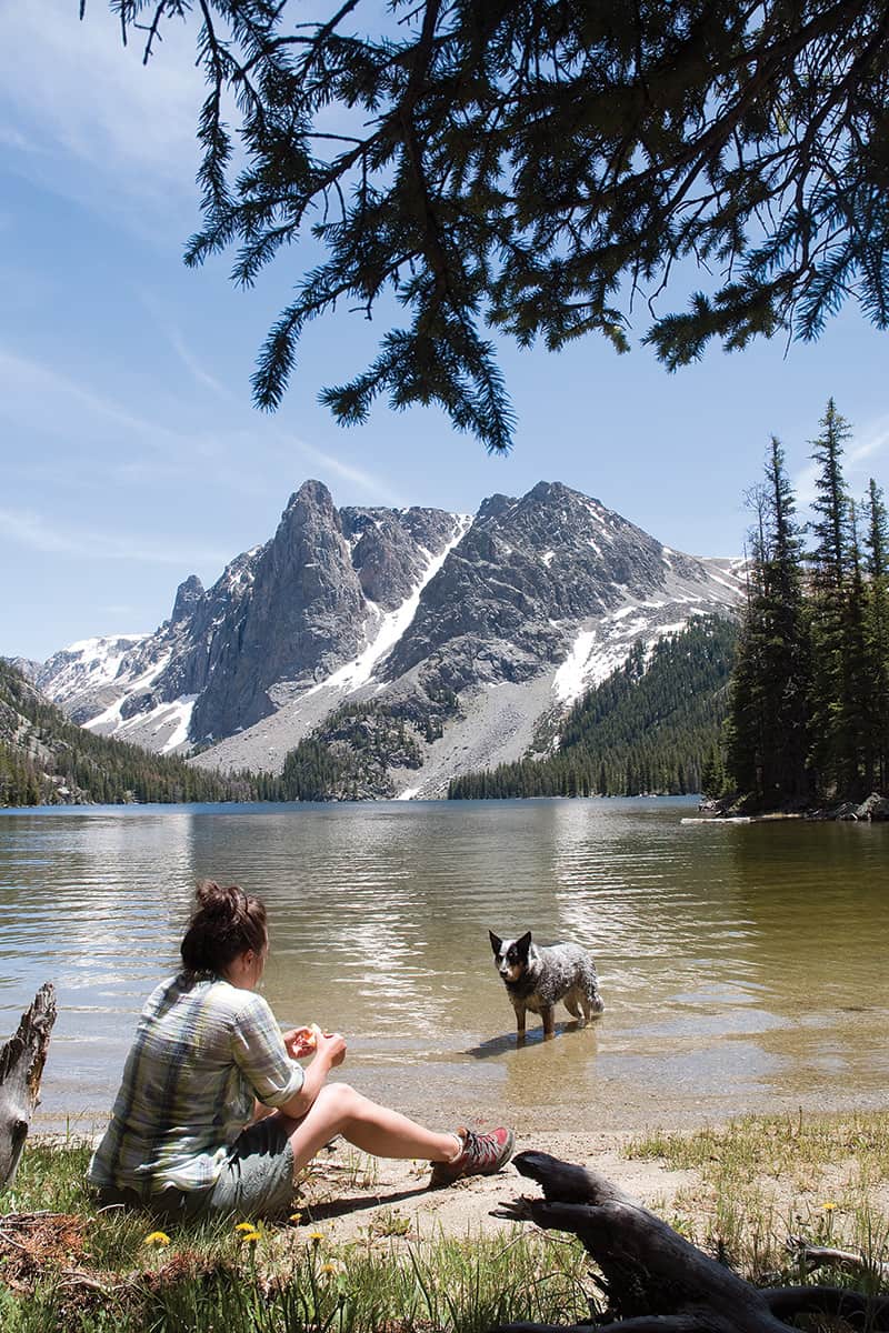
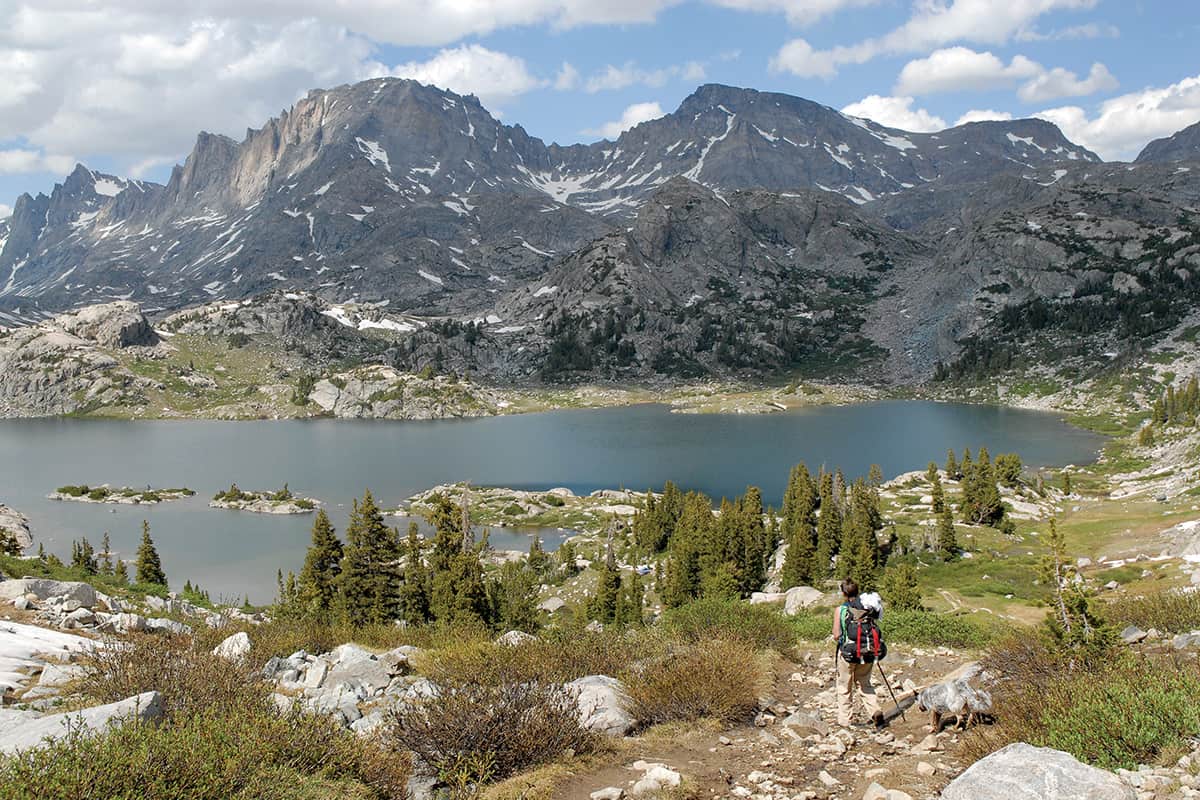
HIKING TO ISLAND Lake, Titcomb Basin, and then an unnamed basin above and east of Island Lake offers opportunities for both the ease of trail hiking and the feeling of exploration that comes when there is no trail. The guardian of the mouth of Titcomb Basin, which has some of the Winds’ most diverse climbing—everything from nontechnical scrambles to an 11-pitch climb up a 1,500-foot wall—Island Lake itself is a popular and worthy destination and camping spot. It is about eleven miles on outstandingly obvious trails from the Elkhart Park Trailhead, a long but doable distance for a day. (If you want to break the eleven miles up into two days, Seneca Lake, as forthrightly beautiful as any lake in the Winds, is about halfway.)
The four-mile (one-way) trail from Island Lake to the back of Titcomb Basin is dazzling. The Titcomb Lakes are brilliantly emerald squiggles reflecting snaggly granite rising on all sides. Plans my boyfriend, Derek, and I have for this trip don’t include camping at Island Lake or hiking into Titcomb Basin, though. Island Lake is where our exploration starts. We continue directly east from it, bushwhacking up a steep, shrubby hillside that eventually flattens out into an expansive basin about 600 vertical feet above the lake. At the back of the basin is what the definitive guidebook to the range, Joe Kelsey’s Climbing and Hiking in the Wind River Mountains, calls Saddle 11,120+. We camp about one mile and several hundred vertical feet below it. While there are more than one dozen tents around Island Lake, only a thirty-minute hike below, we have this entire basin to ourselves.
We set off from camp around 8 a.m. The idea is to make a giant loop by hiking up Saddle 11,120+ then down to Wall Lake and then bushwhacking up to Indian Pass, where we can take a trail back to Island Lake. We’re out for thirteen hours, during which we see between nine and twelve lakes—I lose count—and no other people until we reach Island Lake. We’re on a trail for about one-third of the time. The other two-thirds of the time, I’m neither confused nor terrified. I’ve actually come to prefer exploring the range’s trail-less areas.
The next day, we head north from camp to take advantage of yet another unique feature of the Winds: an abundance of high mountains you don’t need technical climbing skills or equipment to summit. We’re heading for the third-highest mountain in Wyoming, 13,745-foot-tall Fremont Peak. There are technical routes on Fremont, but it’s also possible to reach its summit via a Class III scramble. “Class III” terrain isn’t technically climbing, but requires that you be comfortable with exposure and ascending (and descending) using both hands and feet. Derek and I generally find scrambling exhilarating, and the southwest slope up Fremont is particularly so. Cairns are scarce, so we have to concentrate on route-finding. There are few loose rocks and plenty of low-angle granite slabs. Toward the summit, we encounter both wind and the first people we’ve seen in over twenty-four hours. From the summit we can see several hikers making their way along the Titcomb Basin Trail.
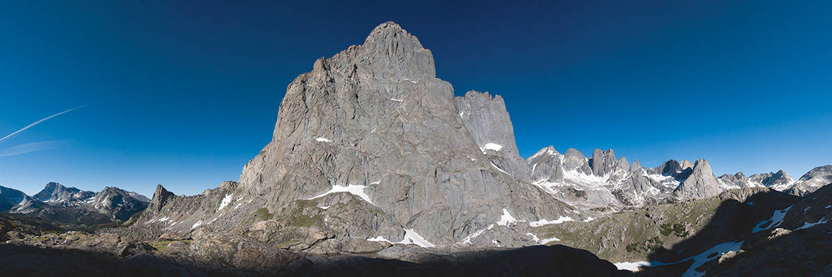
ABOUT THIRTY MILES from Fremont Peak as the crow flies, no one has ever called Squaretop Mountain beautiful. In his book, author Kelsey says Squaretop looks like a tree stump. A massive tree stump. It lords over the Green River Lakes area—one of the range’s closest trailheads to Jackson and where there is also a Forest Service campground—like a traffic accident you can’t look away from. Although not elegant in form, it is one of the most impressive pieces of granite I’ve ever seen. It makes sense that it’s the single most photographed peak in the range. Put the Green River Lakes, stands of aspen stretching along their northeastern shore, in Squaretop’s foreground, and the scene is beautiful.
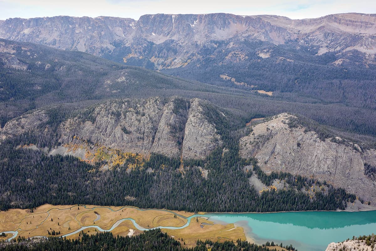
The six-mile Lakeside Trail, offering great views of Squaretop and circling Lower Green River Lake, was my first hike in this area, and it’s the reason Derek and I are back at Green River Lakes the weekend after Labor Day. (The Winds’ hiking season is bookended by mosquito season—skeeters here are notorious for their aggressive viciousness—and snow. I’ve found late August through mid-September is my favorite time to hike in the range.) The standout memory from my Lakeside Trail hike wasn’t the view of Squaretop, but the color of the water in the two Green River Lakes: the same milky green of the middle layer of an Andes peppermint candy. If it looked cool from the lakeshore, I imagine it’ll look extra cool from above.
White Rock, an 11,284-foot-tall mountain whose eastern side is a large, low-angle grassy meadow, is directly above Green River Lakes. We follow trails for more than three miles and then begin exploring off-trail. After an hour of navigating an area of trees downed by an avalanche, and another hour of easy walking above tree line on hummock-y grass, I see I was right. We spend thirty minutes taking photos and eating lunch before mostly retracing our steps. We take a short detour on a trail to Slide Lake. (If you want to hike only to Slide Lake, it’s about ten miles round-trip, all on trails, from the Green River Lakes Trailhead.) En route to the lake, we pass Slide Creek Falls, a steep natural waterslide stretching for several hundred feet. From a couple of spots near the falls you can see the Tetons. The Kelsey book says that, in certain light, you can also see Slide Creek Falls from the Tetons.
Arriving at Slide Lake, I wish we had our camping supplies with us. Since we don’t, Derek and I lie on the small beach of aggressive sand at the lake’s northwestern end and, even though this exploration hasn’t yet ended, begin planning our next one.
Nuts & Bolts
Climbing and Hiking in the Wind River Mountains by Joe Kelsey is considered the ultimate guide to the range. Kelsey’s style is to present basic info and maps, and let readers figure out the rest on their own. Every place mentioned in this article is in Kelsey’s book. Earthwalk Press publishes weather- and waterproof maps of the southern and northern parts of the range. From $10.95, Teton Mountaineering, 170 N. Cache Dr., 307/733-3595. For thirty-two years, Lander Llama Company has offered custom, guided Winds trips on which llamas carry your gear. Call for pricing, 307/332-5624, landerllama.com