Read The
Current Issue
Drive By
We do encourage exploration by foot, but know cars are faster.
BY Maggie Theodora
PHOTOGRAPHY BY Bradly j. boner
GRIPPING THE FORD Ranger’s passenger door handle so tight my fingernails left indents, I was sure I was going to die. The truck, with nothing in its bed and a twenty-five-year-old man at the wheel, fishtailed from one side of the washboarded road to the other. At one point I saw the truck’s bed out my window. I asked Rob to slow down. He grinned and gave the truck more gas. “Welcome to Wyoming,” he said.
I had been in Jackson Hole for less than two weeks and was looking for adventure. When my new roommate asked if I wanted to go camping one night in the Gros Ventre Mountains, of course I said, “Yes.” “There’s this road that goes way into the mountains,” he said. “We’ll drive it for as long as we want and then pull over and take out our sleeping bags. It’ll be a clear night tonight.”
By the time we hit the road it was dusk. By the time the fishtailing started it was dark, and I saw more stars overhead than I had ever seen before. Thank God I couldn’t see the four-hundred-foot drop down to the Gros Ventre River on the passenger side.
Rob kept the truck from crashing, and, farther down Gros Ventre Road than I would have liked, we pulled over and got our sleeping bags out. It was the first time I had ever slept outside of a tent, and I loved it. Driving back to town the next morning, I didn’t think the adventure could get any better. But, now that I trusted Rob’s driving skills more and also because it was daylight, I saw the surrounding scenery, including, in several places, the Gros Ventre River hundreds of feet below. The road passed cliffs that glowed red; green pastures where horses grazed; a long, skinny lake with standing dead trees in the middle of it; and the first landslide I had ever seen. The camping was good, but the drive was great.
While many amazing vistas in this valley require hiking, paddling, or biking, there are some that can be reached via car. Here are a few of our favorite drives:
-
Shadow Mountain/Antelope Flats
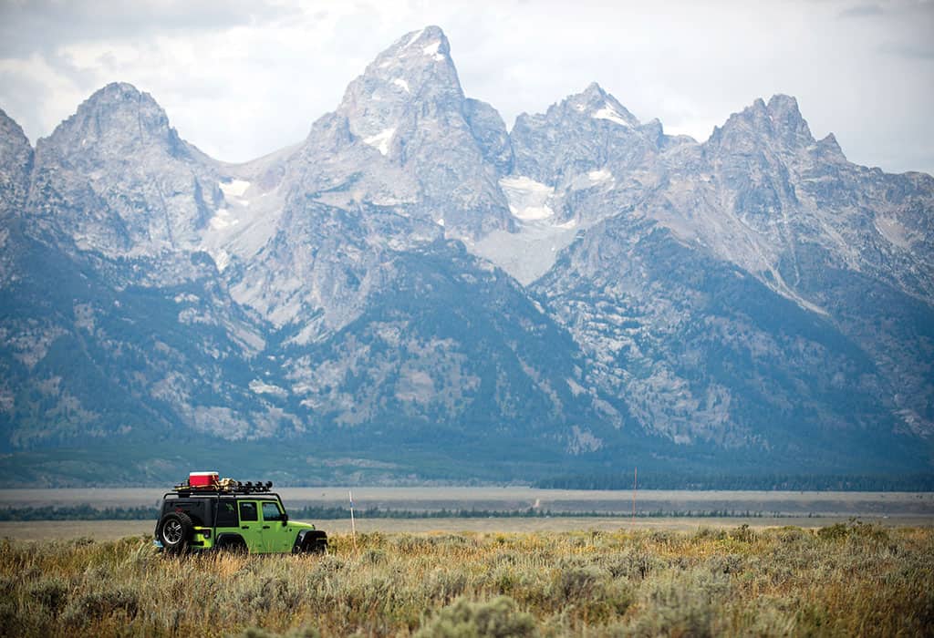
Why: Shadow Mountain, 8,256 feet above sea level, is in the Gros Ventre Mountains, across the valley from the Tetons, which means it has great views of the Tetons. It makes sense that the best Teton views aren’t actually from the Tetons.
The base of Shadow Mountain is in Grand Teton National Park, but the gentle peak itself, which has a hiking/biking trail up it if you don’t have the right car for the drive, is in the Bridger-Teton National Forest.
While Shadow Mountain is the main draw of this drive, the access road to it, Antelope Flats, passes historic Mormon Row, home to arguably the most photographed barn in the country. The valley’s herd of bison (pop. seven hundred) can often be found grazing in the sage meadows around Mormon Row.
Miles: About forty-five round-trip from downtown Jackson
Best time to go: There are few better views in this valley than the sun setting behind the Tetons, and there are few better places to catch the sunset than Shadow Mountain.
Fine print: Any car can handle Antelope Flats; it is newly repaved. The road from the base to the summit of Shadow Mountain is rutted dirt. You don’t need a car with four-wheel drive, but you do want one with at least eight inches of clearance. We do not advise driving up Shadow Mountain if the road is wet.
Bonus: Since it’s in the BTNF, you don’t need permits to camp on Shadow Mountain. There are numerous free car-camping sites at the mountain’s base and off the road to its summit.
Directions: Turn onto Antelope Flats Rd. just north of Moose. Past Mormon Row, when Antelope Flats Rd. intersects Gros Ventre Rd., turn left onto GV Rd. In several miles the pavement ends and dirt begins. This dirt road tracks along the base of Shadow Mountain. About one mile in, it forks; take the right fork and you’ll begin climbing.
GTNP’s Inner Park Loop Road winds past the park’s main peaks. -
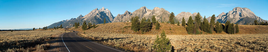
Inner Park Loop Road
Why: This is perhaps the single most beautiful stretch of paved road in the country, and it’s only open to cars from May 1 through October 31.
When Grand Teton National Park’s Inner Park Loop Road was being rerouted and redone in the 1980s and early 1990s, serious thought was given to the experience drivers and passengers would have on the road. It was designed to maximize views. We think the engineers nailed it—the mostly flat road passes South and North Jenny Lake, String Lake, the Cathedral Group turnout, and Signal Mountain.
You can drive it in forty minutes, but it’s worth stopping at pullouts to see glaciers and read about the park’s geology. The Tetons are among the youngest mountains in the world, but some of the rocks in the core of the range are among the oldest in the world.
Miles: About twenty miles from Moose to Jackson Lake Junction
Best time to go: Avoid traffic by going in the early morning or mid-to-late evening.
Fine print: Expect traffic; this drive requires paying the Grand Teton National Park entrance fee ($30).
Bonus: It’s hard to believe, but the views of the park’s highest peaks from the four-mile, one-way Jenny Lake Scenic Loop drive are even better than those on the main road.
Directions: Enter the park at Moose and you’re on this road.
-
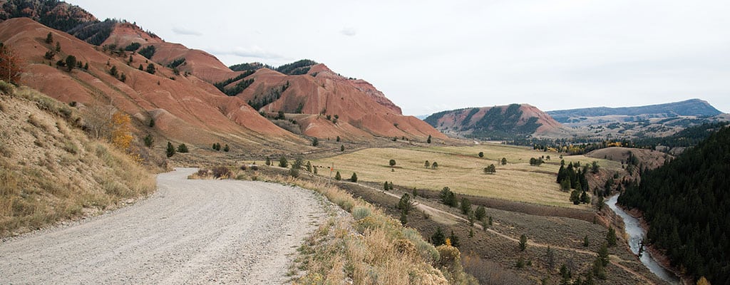
Gros Ventre Road
Why: The Gros Ventre Road starts with a natural warm springs—go ahead and stop for a soak—and then heads east, winding deep into the Gros Ventre Mountains. Most of the time it parallels the Gros Ventre River. Sometimes the road is at river level. Other times it hangs several hundred feet above, carved into the side of a butte.
At its start this road is beautiful pavement. Within several miles, though, it deteriorates—expect sizable potholes and washboard in the dirt—but its condition is not so bad that a regular passenger car can’t handle it, at least for its first ten miles.
This road takes you past Upper Slide and Lower Slide lakes—both formed nearly a century ago by a massive landslide—several unimproved campgrounds, a boat launch, trailheads, the Red Hills, and several historic guest ranches (not open to the public).
The return drive has great Teton views.
Miles: Between forty and sixty from downtown Jackson, round-trip
Best time to go: Early in the day, so you have time for a hike, picnic, bike ride, or paddle along the way
Fine print: This road does not have guardrails. If you are uncomfortable with exposure, you might want to content yourself with the first couple of miles.
Bonus: On June 23, 1925, 50,000,000 cubic yards of debris—enough to bury Washington, D.C., six inches deep—tore off the flank of a mountain just south of this road. The Gros Ventre Landslide is now partially covered by new-growth pine trees, but is still visible from across the valley. Gros Ventre Road passes directly through the slide’s debris field, which today is a National Geologic Site.
Directions: From Jackson head north on U.S. 26/191/89. At the Gros Ventre Junction turn right (east). In six miles you will enter the tiny town of Kelly and the road will make a sharp left. About one-half of a mile after this curve, make a right onto Gros Ventre Rd. Follow it for as long as you like, or as long as your car can handle.

The eight-mile Moose-Wilson Road in GTNP is a favorite spot for moose. Come fall, its aspen trees are among the most colorful in the valley. - Moose Wilson Road
Why: Since this eight-mile, narrow, winding road linking Teton Village and Moose sticks close to the base of the Tetons, it doesn’t offer much in the way of mountain views. But, a couple of falls ago, a section of it was closed due to grizzly bear activity in the area. You never know what kind of wildlife you’ll see on this drive: Moose and elk are most usual, while black and grizzly bears are more rare but possible.
Miles: Eight miles, from Moose to Teton Village
Best time to go: Dawn and dusk have the least traffic and give you the best chance of spotting wildlife.
Fine print: This road is closed to RVs, trailers, and vehicles over 280 inches in length. A one-and-a-half-mile section in the middle is unpaved, but passenger cars are fine on it.
Bonus: Visit GTNP’s 1,106-acre Laurance S. Rockefeller Preserve. Four miles south of Moose on this road, the preserve has its own interpretative center and also some of the flattest hiking trails in the national park.
Directions: From Moose drive past the GTNP Visitor Center and, just before you go through the park’s southern entrance station, turn left onto Moose-Wilson Rd. At its southern end, the road becomes Wyoming Highway 390 and passes Teton Village.

Numerous pullouts along Highway 89 through Snake River Canyon offer views of the river below, one of the most popular rafting destinations in the West. -
Snake River Canyon
Why: The only non-mountain-pass route into and out of Jackson Hole includes a twenty-mile section through the Grand Canyon of the Snake River. Through much of the canyon, U.S. Highway 26/89 is feet from the Snake. Near Hoback, the river is calmer. About twelve miles into the canyon, the river becomes whitewater, with several Class III and IV rapids.
Several pullouts along the way give anglers and kayakers access to the river.
Miles: From Hoback Junction to Alpine, it is about twenty-four miles.
Best time to go: Late morning or mid-evening
Fine print: Many people who work in Jackson live in Alpine, and this road is their commute to and from work. Also, this road is popular with cyclists.
Bonus: About six miles before you hit Alpine, a pullout looks down on two of the biggest rapids in the canyon, Lunch Counter and Big Kahuna.
Directions: Head south from Jackson toward Hoback Junction. At Hoback, continue south to Alpine. JH