Read The
Current Issue
Public Lands in Public Hands
The Wyoming Public Lands Initiative charges communities to come up with recommendations for managing local parcels of federal land long stuck in limbo. Is there a chance it will work? Do we want it to?
By Molly Loomis
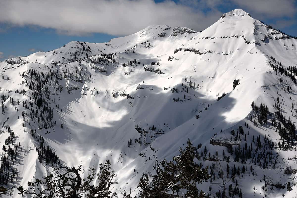
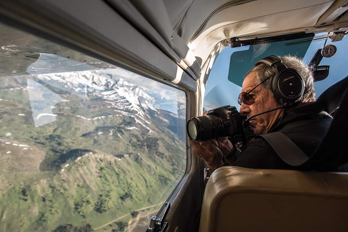
LACKING THE IN-your-face gnarl of the Tetons, the Snake River Range holds its own appeal. Much of the range is part of the Bridger-Teton National Forest (BTNF) and nearly 80,000 acres inside this forest are further protected as the Palisades Wilderness Study Area (WSA). The Snake River Range is where High Mountain Heli-Skiing operates—in winter, open slopes blanketed with powder seemingly stretch on endlessly, making it a heli-skier’s heaven. Year-round in this area adventurers can do single to multiday ski/hiking/snowmobiling tours and see only a handful of other people.
Archaeological evidence shows that until 1868, when the U.S. government dramatically reduced Shoshone territory, Native American tribes seasonally occupied the region. Animals remain year-round residents of the Snake River Range’s forests of subalpine fir and Engelmann spruce, aspen glades, and windswept ridges. Skiing or hiking in the Palisades you might see tracks of wolves, moose, black bears, mountain lions, and, on occasion, maybe even those of a wolverine. In summer, serviceberry, chokecherry, and the evergreen mountain mahogany provide valuable shelter and homes for songbirds, like the green-tailed towhee, white-crowned sparrow, and MacGillivray’s warbler. In the range’s western reaches along Wolf Creek, a congressionally designated Wild and Scenic River, are rare breeding pairs of Harlequin ducks. Last winter, there were rumors of a grizzly den in the range.
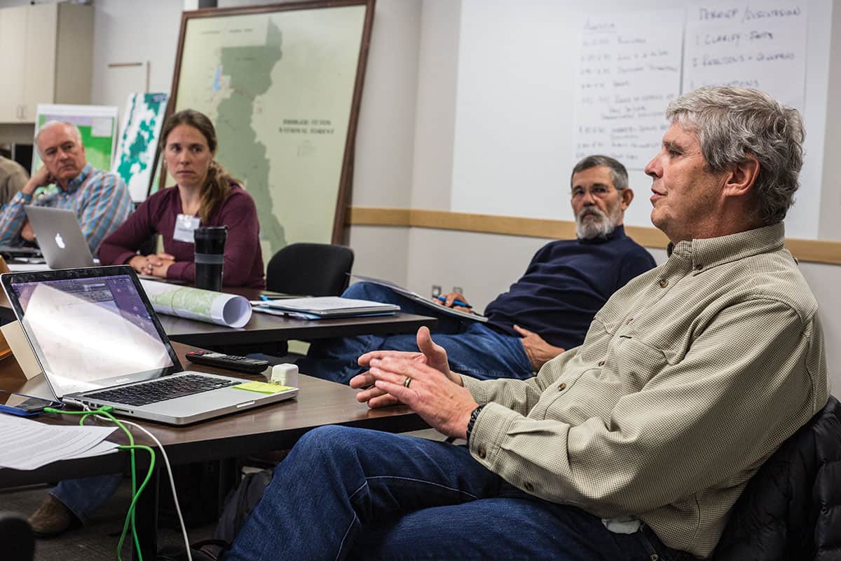
Less than thirty miles away from the Palisades, twenty people charged with collaborating to determine its future sit in straight-backed office chairs in the Teton County Commissioners Chambers. They study maps of the region while a projector hums at the ready for a PowerPoint presentation. This crew of mustaches, cowboy hats, Danskos, tattoos, and button-down shirts makes up Teton County’s Wyoming Public Lands Initiative (WPLI, the acronym is pronounced “whip-lee”) Committee, one of eight such committees throughout the state that the Wyoming County Commissioners Association (WCCA) created in 2015. Their task is to provide the elected Teton County Board of County Commissioners with recommendations on what to do with the Palisades WSA and the nearby Shoal Creek WSA. How both of these areas should be managed—what type of recreation is allowed, how much use is allowed, and even who should manage them (the federal government versus state government)—has been in limbo for nearly thirty years.
Members of the Teton County WPLI Committee come from conservation, user, and special interest groups, as well as the general public. Six members are conservationists from local and national organizations. Seven people represent “special interests,” which include industry; nonmotorized, motorized, and mechanized recreation; and agriculture/ranching. The remaining members were selected by Teton County commissioners from the general public and have diverse backgrounds, from law to guiding to landscaping.
How Palisades and shoal creek wilderness study areas should be managed—what type of recreation is allowed, how much use is allowed, and even who should manage them (the federal government versus state government)—has been in limbo for nearly thirty years.
IN 1964, THE Wilderness Act preserved 9.1 million acres of federal land as wilderness, a new-at-the-time land-use designation. (While some wilderness areas were designated in Wyoming in 1964, additional areas were set aside as wilderness in 1984 as part of the Wyoming Wilderness Act. In total, the state today has fifteen wilderness areas.) The purpose of a wilderness designation was (and is) to maintain land in as natural a state as possible. It is the most protective designation given to a parcel of federal land, even more so than a national park designation. Roads and structures cannot be built in wilderness, and motorized and mechanized recreation is prohibited (with the exception of a few instances where they were grandfathered in).
The original Wilderness Act and the 1984 Wyoming Wilderness Act also directed federal land agencies to review other areas in their jurisdictions for wilderness qualities. At the time, these were designated wilderness study areas; the idea was that some of them would become full-fledged wilderness areas in the future. More than 500 areas across the country—forty-five of them in Wyoming—have been designated as WSAs, including Palisades and Shoal Creek.
WHILE WILDERNESS AREAS are managed according to known regulations, WSAs didn’t come with clear management plans or usage rules. This resulted in widely varying and very localized— and often confusing and contradictory—management plans. For example: The Palisades WSA, which totals 130,000 acres, borders the Caribou-Targhee National Forest’s (CTNF) 61,000-acre Palisades Recommended Wilderness Area. (In the late 1990s, the CTNF decided this area should be designated recommended wilderness rather than merely WSA.) While it awaits official designation, CTNF manages that land as if it were already wilderness; motorized and mechanized devices are prohibited. But the neighboring Palisades WSA allows some use by mechanized and motorized means at certain levels. So mountain biking, snowmobiling, heli-skiing, and dirt biking are allowed in parts of it, but not in the adjacent 61,000 acres.
WSAs were not meant to be in limbo for perpetuity. After WSA designations were made, federal land agencies with any in their portfolios were tasked with submitting recommendations to their respective state legislatures for a WSA’s future management: to be a wilderness or not. The BTNF had its recommendations for Shoal Creek and its portion of Palisades ready in 1990—the recommendation was to make both full wilderness areas, as a handshake agreement between conservationists and legislators at the time these WSAs were designated promised—but bureaucracy, contention, and litigation interfered, and kept interfering. And now, here we are twenty-eight years later with no plan for what to do with either of these areas. The WCCA sees WPLI as a way to get things moving again.
ACCORDING TO WCCA’S Natural Resource Staff Attorney Gregory Cowan, the governor’s office, the WCCA, and various county commissioners were growing increasingly frustrated with Wyoming’s WSAs being in limbo. WCCA’s ambitious goal is to get counties, through local WPLI committees, to create individual management plans for their WSAs. These plans would then be reviewed and, eventually, perhaps ratified by first the state legislature, then the U.S. House of Representatives.
But before it has released a single recommendation, WPLI is controversial. The public has asked whether an organization whose website lists multiple oil, gas, and energy companies as business partners is the right one to make an unbiased recommendation about the future of public land. And what about Wyoming counties, some of which are heavily reliant on an extractive economy—can they be impartial?
“That’s a fair question,” Cowan says. “WPLI is not being supported financially by our business partners. I reject the premise that because oil and gas would be supporting WCCA or WPLI that it’s somehow bad. We hold ourselves accountable. That’s where transparency really comes into play.” Cowan continues, “WPLI represents the pursuit of an opportunity. We don’t have the external factor forcing us to do this like the threat of a national monument proclamation.” (Due to concessions made when present-day Grand Teton National Park was created in 1950, Wyoming is the only state fully exempt from Presidential National Monument declarations. Other states worry about presidents stepping in and unilaterally proclaiming federal lands, including WSAs, to be a national monument. Such a move is almost always unwanted by states and also controversial within the general public because it reaches over both.)
It’s not about, “Where can I do my activity?” but instead “looking at the future and what I can do to protect these lands. It’s not [about] what’s going to happen in the next five years. It’s [about] what’s going to happen in the next fifty years.”
— Linda Merigliano, BTNF North Zone Wilderness and Recreation Program Manager
TO DATE, TEN of the thirteen Wyoming counties with a WSA in their borders are participating in WPLI. Given the complexities of the process, it’s beneficial that facilitators from the University of Wyoming’s (UW) Ruckelshaus Institute, which specializes in collaborative decision-making on complex environmental topics, are helping. “You’re trying to expand options to all parties so that all parties can maximize gains and walk away from these agreements pretty well satisfied,” says UW’s Spicer Chair of Collaborative Practice and Lead Facilitator Steve Smutko. The institute hopes to teach WPLI committees how to navigate the nuances of collaborative decision-making. Three of the ten counties working on creating new recommendations, including Teton County, have accepted the institute’s offer.
Since Teton County has a deep and uniquely powerful lineage of environmental advocacy, the hope is that it may emerge as a leader in WPLI. (Jackson locals were instrumental in drafting the original Wilderness Act, in establishing Grand Teton National Park, and in placing thousands of acres of open space in the region under conservation easements.)
Smutko readily admits the process is going to be difficult, though. The WCCA didn’t stipulate guiding parameters for committees: There is no recommended overarching context to work within, such as a county’s comprehensive plan, maximizing economic development, or habitat resiliency in a changing climate. Also, counties have radically varying outlooks toward public land and who should have a say in how it’s managed.
Cowan emphasizes WPLI is a user-based process. (An important group of users has been overlooked, though: No counties, including Fremont, home to the Wind River Reservation, have tribal representation on their WPLI committees.) “If this were done as a state, it could be done in its totality,” Smutko says. “[But done county by county] Sublette County may say, ‘Shoal Creek is the prime wilderness area for us,’ while Teton County says, ‘We’re going to use Shoal as a sacrifice for Palisades.’ ”
Teton County is showing this might not be as hopeless as it sounds, and that even if it is, there is benefit to the process. The county’s WPLI committee includes Dan Smitherman, a rancher and former Marine who led the battle against drilling in the Wyoming Range and now works for The Wilderness Society, and also Jim Woodmencey, a meteorologist, avid mountain biker, former ranger, and High Mountain Heli-Skiing guide. Smitherman represents the conservation viewpoint, and Woodmencey was tasked as the winter commercial motorized recreation representative. Woodmencey says, “If nothing else, it gives everyone a chance to understand the other side’s perspective.” Smitherman agrees: “Nothing may be accomplished legislatively, but I hope we’ve at least turned a page in Wyoming where we can sit across a table and discuss these things. If we can navigate this type of discussion to other issues in Wyoming, then it’s been a success. It may not be the perfect opportunity. But it’s an opportunity.”
Not all counties are as open to discussion. Park County, home to the McCullough Peaks and High Lakes WSAs, has already announced it won’t accept recommendations for any areas outside of its borders. In a December 2016 letter to the Wyoming Congressional Delegation, commissioners from Lincoln County, which includes 62,637 acres of the Palisades WSA, wrote, “Wilderness is not an appropriate, effective, efficient, economical, or wise use of land,” and that “ultimately, the transfer of Federal lands to State ownership/management is the only solution big enough to address the myriad of issues facing the West.” This letter reveals that some interested groups aren’t just asking the question, “Should a WSA become a wilderness area or not?” but also, “Should the federal government even have jurisdiction over it?”
TURNING OVER FEDERAL land to the state is not a new idea. In the 1970s and ’80s, the Sagebrush Rebellion, named for the vast tracts of sagebrush occupying much of the western land in question, gained momentum in direct response to the roadless inventories that created wilderness areas and WSAs. The movement sought to turn over federal land to state and private control, thereby possibly lessening rules, regulations, and the costs associated with grazing, mining, road building, and other extractive industries.
This long-simmering rebellion has gained new life. The Republican platform has recently adopted language to support public land transfers to states. On the first day of its 2017 session, the U.S. House of Representatives passed a rule designed to make transfers of federal land to states easier. Thus far, Wyoming Governor Matt Mead and Cowboy State citizens seem committed to maintaining the status quo of the ownership of federal land in the state. A 350-page state-funded report released in October 2016 made multiple cases against federal-to-state land transfers. The report concluded that, among other things, doing this would create economic hardship for Wyoming, including a loss of nearly $30 million in federal funds.
In December 2016, Mead described the transfer of federal land to Wyoming as “legally and financially impractical,” referring in part to the cost of fighting wildfires. Still, some Wyoming state legislators, rallying behind Republican Senator Larry Hicks, who represents Albany and Carbon Counties, are pushing for an amendment to the Wyoming Constitution that would enable the state to own and operate federal public land by 2019. If the GOP’s platform succeeds, the rebellion may escalate into all-out war. The BTNF’s North Zone Wilderness and Recreation Program Manager Linda Merigliano says the real threat isn’t WSAs being in limbo, but of “having some sort of designation that makes it easier to transfer these lands to state control.” She continues, saying that it’s not about, “Where can I do my activity?” but instead “looking at the future and what I can do to protect these lands. It’s not [about] what’s going to happen in the next five years. It’s [about] what’s going to happen in the next fifty years.”