Read The
Current Issue
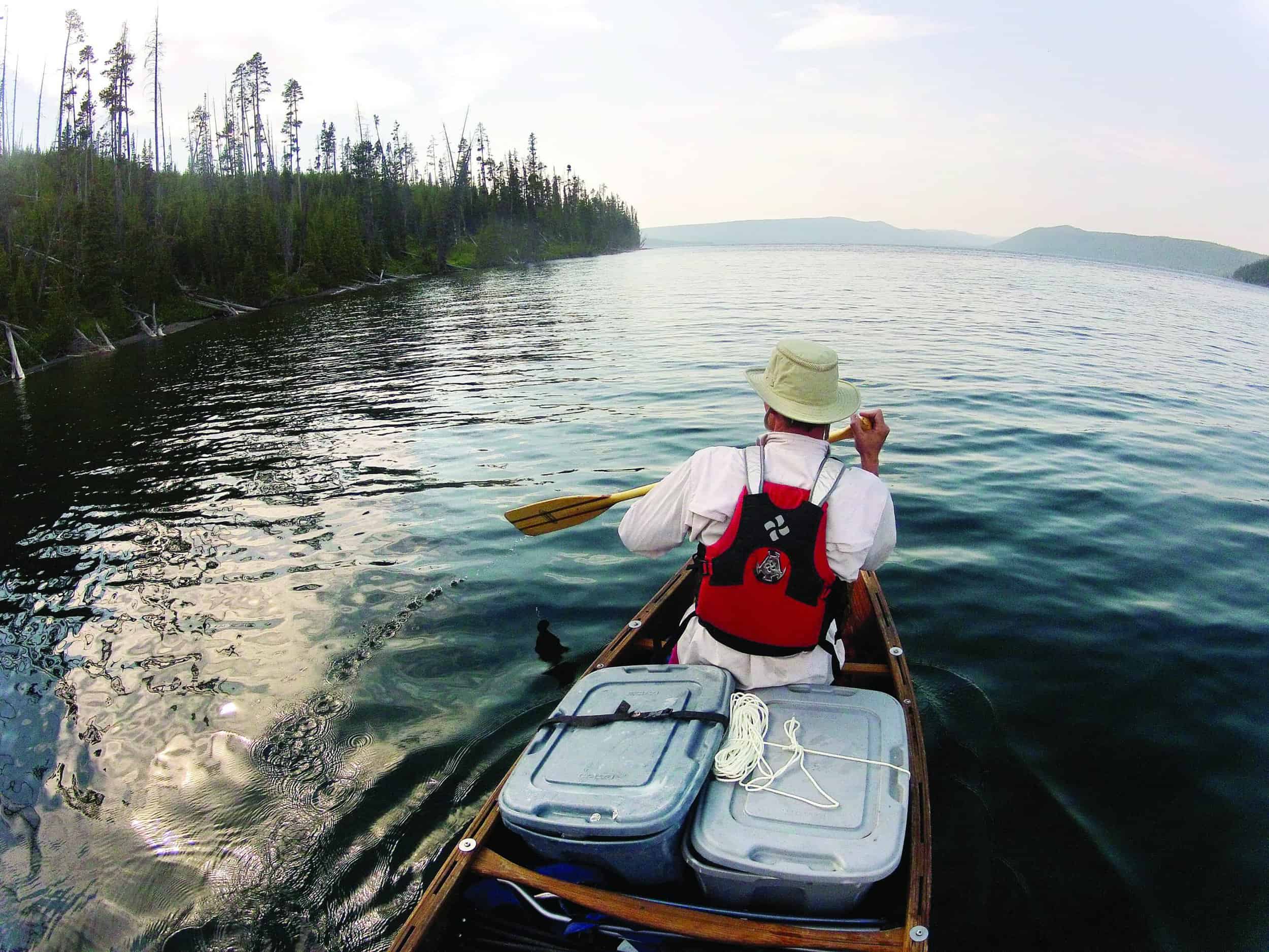
A wooden canoe carries all the creature comforts for a scenic trip on one of YNP’s largest and most remote lakes.
// Photography and story by Bradly J. Boner
cannot be reached by a road.
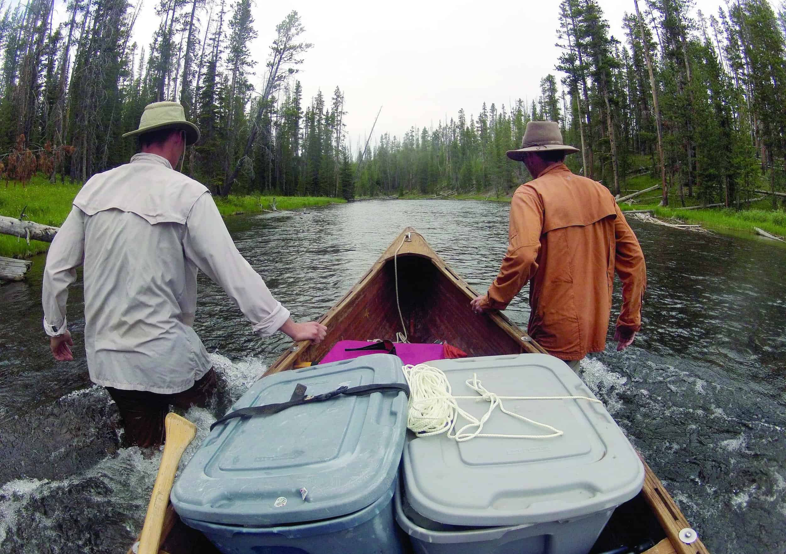
On a sunny July morning in Yellowstone National Park, my brother and I wade into chilly waters at the boat launch on the southern end of Lewis Lake. We had loaded three days’ worth of gear and are ready to hop into our intrepid vessel—an old handmade wooden canoe I had patched up and repainted a few years before. We push off and aim the bow at the opposite shoreline.
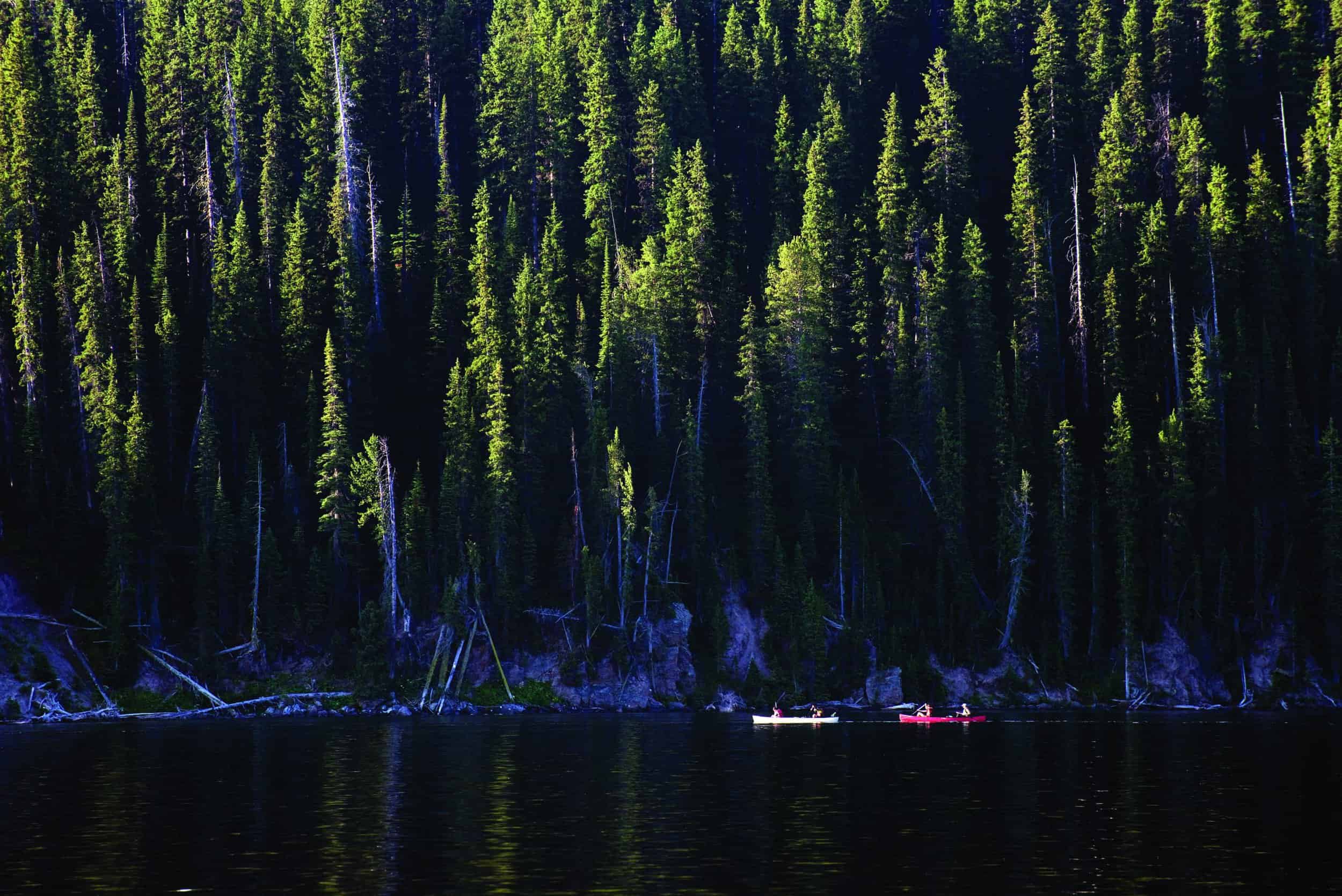
After hugging the western shore for about an hour, we come to the northern end of the lake and enter the Lewis River Channel, the only section of river in Yellowstone that allows boats. The channel is three miles long. (Kayaks, canoes—all watercraft—are banned on all other streams and rivers in the park, including the mighty Madison and Yellowstone Rivers and the Lewis River as it flows south from its namesake lake). Like all of the larger lakes in the park, Lewis Lake can be whipped into a frenzy of white-capped waves by summer afternoon winds, but the channel is protected on either side by the dense lodgepole pine forests that cover much of Yellowstone. Depending on the time of day, the transition from the lake into the calmer channel can be stark.
The clear waters of the Lewis River Channel are gentle and easy to navigate. However, paddling from Lewis Lake to Shoshone Lake we’re going against the channel’s current, and after about two miles, the channel constricts and the current becomes just swift enough to render our paddle strokes ineffective. We step out and use rope to guide the canoe for about a mile—sometimes we walk along the shoreline, other times we wade in the rocky-bottomed channel itself. Eventually the vast expanse of Shoshone Lake—the headwaters of the Lewis River—lies before us. With a surface area of more than 12.5 square miles, it is the largest lake in the lower forty-eight states that is not accessible by road. (In Yellowstone, it is the second-largest lake, period.) Here, unlike Lewis Lake, there are no motorized boats allowed, so canoeing Shoshone Lake is a more primitive adventure.
With a surface area of more than 12.5 square miles, Shoshone Lake is the largest lake in the lower forty-eight states that is not accessible by road.
The sand bars where Shoshone Lake funnels into the Lewis River Channel are a good place for day-trippers to relax and picnic before pointing their boats south and downstream for the return trip. Since we’re staying for a couple days, we continue a short distance around the lake’s southern end to our first campsite (8Q6), one of twenty backcountry sites that dot Shoshone’s shoreline. Thirteen of these are reserved for boaters and inaccessible from any of the trails in the area.
I equate canoeing to car camping on the water because of the amount of gear that can be comfortably stowed into the boat. While keeping a certain level of efficacy, a canoe can handle much more gear weight and mass than a kayak can. In our canoe, alongside our standard camping gear, we have three days’ worth of beer, a small cooler, a pair of fold-up chairs, and, in addition to two tents for sleeping, a tall, ten-foot-by-ten-foot screen tent that will, when we’re inside it, protect us from the relentless onslaught of mosquitoes that swarm Yellowstone in July and early August. Our cooler carries real food; there will be no dehydrated lunches or dinners on this trip. In my younger days, I might have turned up my nose at such creature comforts in the backcountry, but now—older and wiser—I find camping in style, if it’s possible, makes the end of a long day on the water more comfortable.
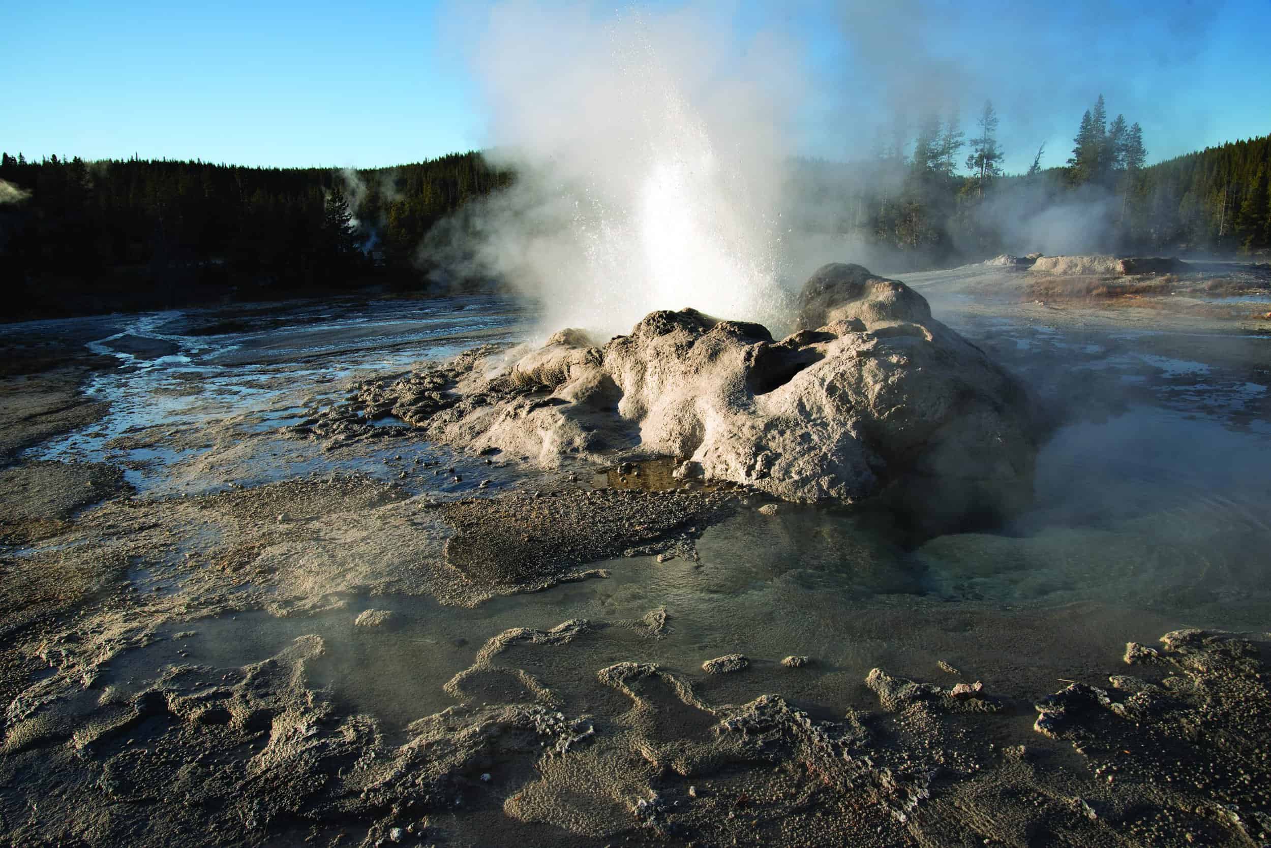
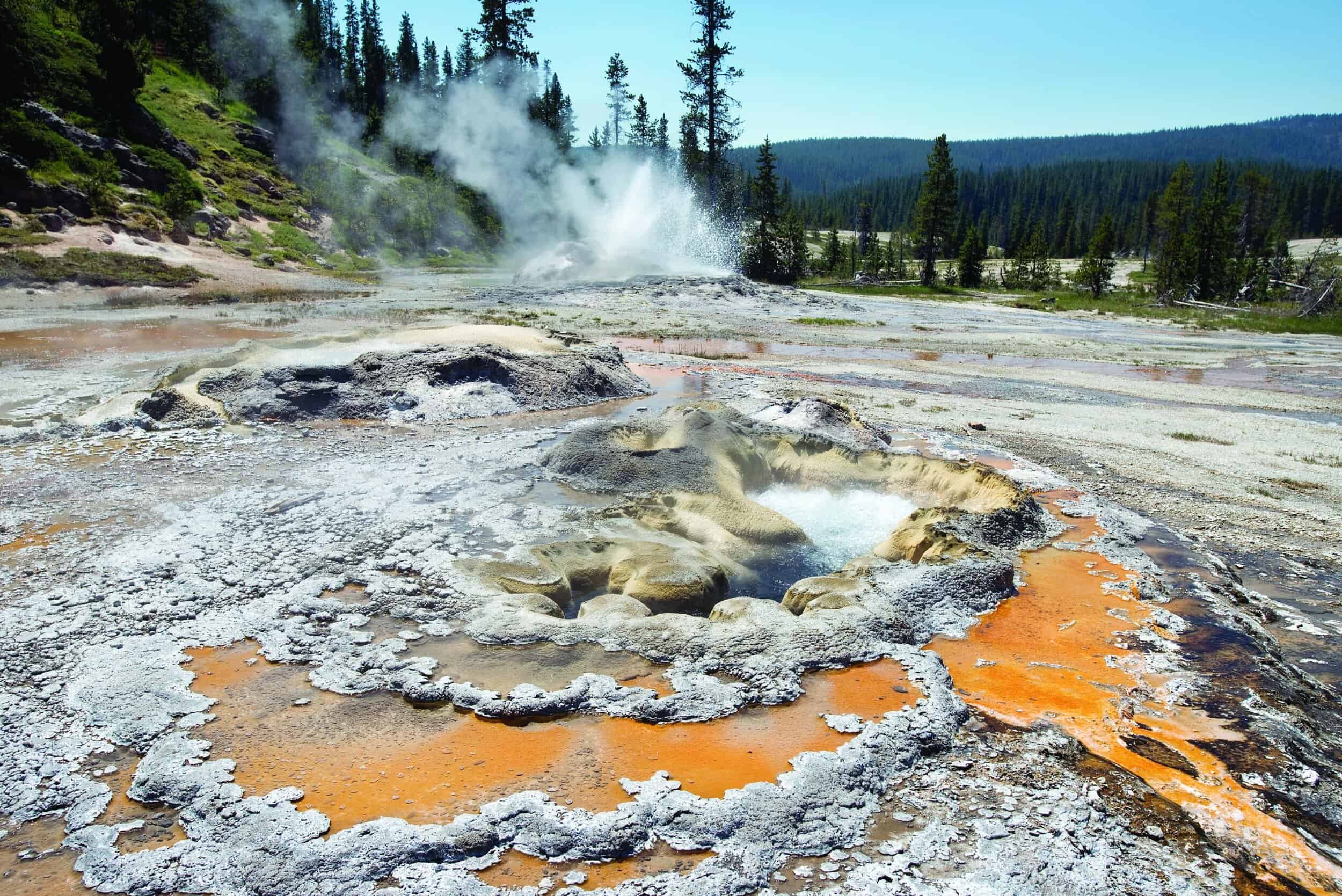
Up at dawn the second day, we eat, pack up, and shove off early. The paddling is uneventful, and at the lake’s western end, we find a large sand bar. It provides an excellent landing spot and jumping-off point for the ten-minute hike to the Shoshone Geyser Basin. This geyser basin is smaller than others in the park but no less active with bubbling hot pots and spouting geysers. When exploring this primitive area, take extra caution because there are no boardwalks like at Old Faithful and Norris. The extra care is worth it though; missing along with the boardwalks are the crowds the more popular and accessible thermal basins draw.
There may be no safe place to be in a boat on Shoshone Lake when even the slightest whitecaps are present, and they are definitely visible now as we look east across the water. We take our time exploring the geyser basin, eat lunch, and walk along the beach to kill time before agreeing the waves look manageable and putting our boat back onto the water. With the wind at our back, we arrive at our second campsite (8S7), on the north shore, within an hour.
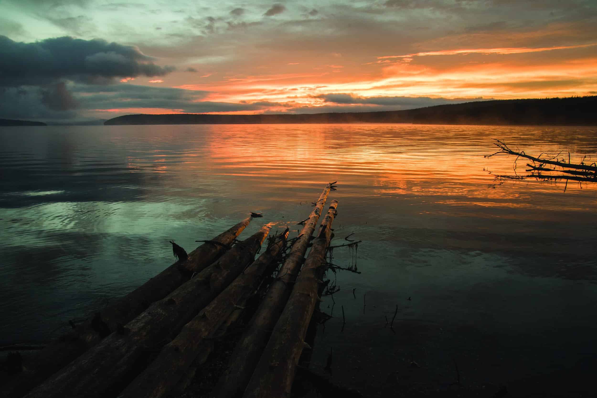
I have never found a bad place to watch a Yellowstone sunset, and this campsite is no exception; the water settles to a glassy calm, creating a near-mirror image of the forest across the lake to the east while the disappearing sun paints the trees a hue of orange so deep it almost looks as if they are ablaze. After dinner we hang our cooler, food bag, and toiletries high on the site’s bear pole using a stout rope-and-pulley system (two more items easily stowed in a canoe but impractical to carry on a backpacking trip). As we turn in for the night, the repetitive sound of ripples splashing against the shore lulls us to sleep.
As relaxing as the prior morning was, this morning is urgent—it is essential that we cross the lake as early in the day as possible, preferably just after sunrise. This early crossing is important because The Narrows, where we will cross, and, at one-third of a mile, the shortest distance between the north and south shores, often gets whitecaps earlier than the rest of the lake. Over the years, a handful of canoes and kayaks have capsized in The Narrows, some proving fatal for the paddlers in them. We agree to eat breakfast once we’ve made it across safely and eat only a snack before leaving the campsite.
Once across Shoshone Lake, the going is easy. The current pulls us down the Lewis River Channel and back to Lewis Lake and its motorboats and other watercraft. Within an hour of the channel depositing us in Lewis Lake, we’re back at the boat launch, and I’m already thinking about a return trip.
Details
A boat permit is necessary for outings on any of Yellowstone’s lakes. Get these at the ranger stations at Bridge Bay, Grant Village, or Lewis Lake. Rangers will also inspect your watercraft to make sure it is free of aquatic pests like quagga mussels, an invasive species that could wreak havoc on Yellowstone’s native ecosystem. Everyone in your party must have a personal floatation device (i.e. a life jacket).
Campsite reservations are required for multi-day excursions in the park. Sites fill up quickly, and it’s recommended that you map out your itinerary and submit an application by the March 31 deadline. Applications filed by this date are processed in a random lottery. Reservation requests made after April 1 are processed in the order they are received starting after all of the lottery applications have been handled. nps.gov/yell/planyourvisit/backcountryhiking.htm
A Little History
European trappers likely first visited Shoshone Lake in the early to mid-1800s. During that time, it cycled through a number of unofficial names, including Snake Lake, DeSmet’s, DeLacy’s, and Madison Lake. (For a time, it was mistakenly thought to be the headwaters of the Madison River.) “Shoshone Lake” first appeared on official maps from the second Hayden Survey to Yellowstone in 1872. The park’s second superintendant, Philetus Norris, called the name “a fitting record of the name of the Indians who frequented it.” The Shoshone tribes lived primarily southwest of today’s Yellowstone National Park, however there is abundant evidence Native Americans routinely migrated through this region.
Since weight isn’t an issue when canoe camping, consider these splurges that you’d likely not bring if you had to carry them in a backpack.
There’s a reason Chaco’s Z/1 sandal has been a classic since its introduction in 1989. Adjustable straps ensure a secure, custom fit and a podiatrist-certified LUVSEAT footbed provides all-day comfort, whether you’re sitting in a boat paddling, walking in the water, or hiking around camp. From $95
Ust’s new self-inflating Fillmatic Camp Comfort Air Mat inflates in just seconds, and its four-inch foam core makes it hard to tell you’re not in your bed at home. From $179.99 JH