Read The
Current Issue

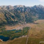
The Birth of Backpacking
Conceived of almost 30 years ago, the Great Divide Mountain Bike Route is as much of an adventure as ever, and it passes through Jackson Hole.
// By Molly Absolon
Less than an hour ago, at the start of the 2,700-mile Great Divide Mountain Bike Route (GRMBR), my husband, Allen, and I posed for a photograph. Fresh, clean, fit, and full of enthusiasm, we smiled for the camera and then set off. But now—only three miles in—we’re turning around. Allen’s pedal fell off. And, because we dare to think it can’t get much worse, it starts pouring rain. This could be a very long—or a very short—trip.
Fortunately, most of the road back is downhill, which allows Allen to coast. A mechanic at a bike store in Canmore, Alberta, gets the pedal back on, and we start again. Thirteen miles later, we arrive at our planned camp. Settling down for the night, I hope our mechanical issue is not a sign of things to come.
The Great DivideMountain Bike Route, which traverses two Canadian provinces and five Western states, crossing through Jackson Hole at the northern end of the valley, began in 1990 as a casual conversation between Gary McFadden, the then-director of Adventure Cycling—a bike-touring and advocacy group based in Missoula, Montana—and his assistant director, Michael, better known as Mac, McCoy.
McCoy lived in Teton Valley, Idaho, for years and served as the editor of this magazine from 1999 to 2012. He and his wife, Nancy McCullough-McCoy, started Powder Mountain Press in Driggs, which, among other things, publishes Teton Valley magazine. McCoy met his wife working at Grand Targhee Resort in 1974, so they have deep roots in the Tetons although they’ve now retired to Arizona.
McCoy wrote the GDMBR guidebook in 2000. Allen and I read the 2013 version each night before we went to bed.
Mountain biking was a nascent sport in 1990 when McFadden and McCoy’s conversation took place, but bike touring was not. Adventure Cycling, originally called Bikecentennial, had been in operation since 1973. The organization’s original purpose was to host a group cross-country ride to celebrate the nation’s 200th birthday. Roughly 4,500 cyclists participated. Following that success, Bikecentennial morphed into a nonprofit membership group designed to support traveling bicyclists, create new multiday routes, provide maps, and conduct bike tours. In 1990, the group’s name was changed to Adventure Cycling.
McCoy worked on and off for Bikecentennial/Adventure Cycling throughout the 1970s, 1980s, and 1990s, mapping out routes and leading trips as well as doing his own tours with Nancy. Those rides were on pavement until 1985, when the McCoys bought a pair of Cannondale mountain bikes, the first fat-tire bikes sold in Missoula, and discovered the joys of riding on dirt, away from traffic.
“We decided why not put panniers on our mountain bikes and tour off-pavement? So, we took a five-day experimental trip, riding on dirt roads and trails from Kemmerer, Wyoming, around the Wyoming Range into Jackson Hole,” McCoy says. “I didn’t know anyone who was putting panniers on their mountain bikes in those days, but it worked. The trip was hard, fun, and a real adventure.”
And it got McCoy thinking about something longer. “I worked for the forest service up in northwestern Montana one season, and part of my job was to ride my motorcycle on closed logging roads to document their condition,” he says. “That opened my eyes. If this one ranger district had that many gravel roads you could ride a bike on, what about the rest of the country?”
The allure of dirt roads proved to be irresistible. McCoy isn’t sure whose idea the Great Divide Route was, but both he and McFadden quickly grew excited by its promise. Still, it took some convincing for Adventure Cycling’s board of directors to buy in. The organization was strapped for cash, and the idea of mountain bike touring—what we now call bikepacking—was virtually nonexistent at that time.
After a couple of meetings with McFadden cajoling the directors, they agreed to set McCoy loose to try to come up with a route through Montana, figuring if they could make something happen close to home, they could probably find a route farther south. McCoy’s first attempt along the eastern side of the Rocky Mountain Front in Montana failed. He ran into too much private land and too many access issues. A year later, he tried again on the west side of the divide, and this time he managed to put together a feasible path from Eureka, Montana, near the Canadian border, south to Idaho.
At that point, Travel Montana picked up on Adventure Cycling’s idea and put together a press junket that included writers and photographers from a variety of magazines, including Sports Illustrated, Men’s Journal, Outside, and Bicycling. The subsequent publicity attracted more attention, bringing with it money—and a red Jeep, donated by a car dealership in Missoula—to keep the project rolling.
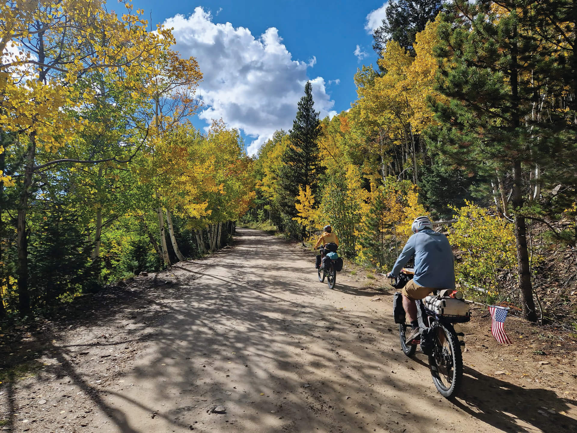
I round the corner and stop. We are heading up one of the GDMBR’s 30 or so crossings of the Continental Divide—this one near Lincoln, Montana—and it’s a doozy. Ahead, the road rises steeply. Loose melon-sized rocks litter its surface. There is no way I can ride it. I see Allen ahead, pushing his bike. I dismount and start doing the same. As the angle grows steeper, it is harder and harder to move upward. Loaded down with camping gear, clothing, food, and water, my bike weighs at least 45 pounds. On the shifting, angled terrain, this feels like a lot. I take one step forward, move my bike a foot or so, squeeze the brakes so I don’t lose ground, and then take another step. Slowly I inch upward.
After about 30 minutes, the road tops out on an open ridge from which the views fall away in all directions. What follows is a glorious, flowy descent through golden meadows and aspen forests to the famous Llama Ranch, a day’s ride from Helena, Montana, and a piece of paradise for bikepackers and Continental Divide through-hikers. Run by Barbara Nye and John Keller since the late 1990s, the ranch offers accommodations, food, and even beer, wine, and chocolate milk for free.
John welcomes us and gives us a tour. He explains that they don’t ask for money; instead, they hope guests will pay it forward and help others as a way to spread goodness in the world.
McCoy spent several years researching the Great Divide Route. He biked some sections and drove others in the donated Jeep. He backtracked hundreds of miles when options failed to pan out and encountered snow drifts, floods, and even a fence that mysteriously locked behind him. In 1997, Adventure Cycling released its first map of a 2,465-mile route from the Canadian border to the Mexican border. (Later, the route was extended, and its northern terminus is now in Jasper, Alberta.)
Labeled a mountain bike route, the GDMBR has little in the way of singletrack. It consists of forest service roads, two-tracks, gravel byways, and occasional stretches of highway that parallel the Continental Divide. Riders pedal through Alberta, British Columbia, Montana, Idaho, Wyoming, Colorado, and New Mexico. It’s not particularly technical, but it’s long, remote, and includes nearly 200,000 feet of climbing.
According to Bikepacking.com—a resource started in 2012 for people who want to explore the world on bicycles (think gear reviews, packing lists, and, most important, route information)—the GDMBR is the most recognized and important off-pavement cycling route in the United States, if not the world. Many consider it the birthplace of bikepacking, a sport that has become hugely popular in the last 15 years. The route was the first of its kind—anywhere—and has inspired the development of many other routes in the years since it was mapped. Now, there are countless off-pavement options for adventure cyclists to explore around the world.
Once the GDMBR was established, it didn’t take long for people to start wondering how fast they could ride it. At first, the handful of cyclists attempting the route were taking six weeks to two months or more to complete the ride. John Stamsted, an endurance mountain bike racer, thought he could do it faster. He ran into a number of obstacles during his 1999 effort, but he reached Antelope Wells on the Mexico border in 18 days and five hours. The bar was set.
In 2004, Mike Curiak issued a challenge to “anyone and everyone” to join him in racing the Great Divide. Six people took him up on the offer. Four finished. Curiak set a new course record of 16 days and 57 minutes, with the second-place rider coming in a mere 20 minutes behind him, and so began what has become known as the Tour Divide, a rugged, unsupported, informal race. For the most part, the race follows the GDMBR, though in places it deviates. The exact reasons for these deviations vary—in some places it’s to avoid areas of snow or burn, in others, it’s to skip a section of pavement. The deviations can change from one year to the next, but, in general, the two routes follow a similar path.
In 2007, Jay Petervary, an adventure racer from Victor, Idaho, did the Tour Divide. He set a new course record of 15 days, 4 hours, and 18 minutes and discovered a new career. “That race was life changing,” Petervary says. “I loved the style of racing. I was burned out on 24-hour events. I wanted to go longer. I loved going in and out of towns, meeting people, and seeing these out-of-the-way places. I loved the challenge of figuring out how I could go faster. I geek out on every piece of equipment I carry. I make things for my bike. I’m always experimenting. I loved pushing myself to see how hard I could go.”
But while Petervary likes to push himself, he also loves that other people are discovering bikepacking and the GDMBR without the goal of going fast. He and his wife, Tracey Petervary (with whom he shares the record for the fastest Tour Divide on a tandem bicycle), have started a business, The BikeTender, in Victor. It offers guiding services, classes on bikepacking, and shuttle rides. “The Great Divide is special,” Petervary says. “Now, more and more people are riding it. Families do it. You can do it in two weeks or 90 days. It doesn’t really matter. What matters is that you are doing it. It’s our backyard, and I believe the only way to really explore it is by bike. You can’t get the same experience in a car.”
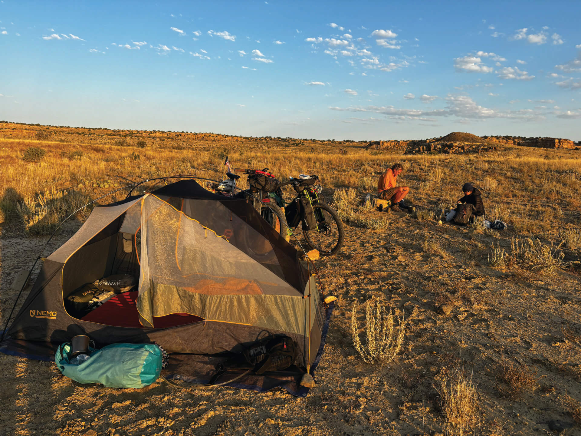
The challenge. The length. The remoteness. The trail magic. The beauty. There’s something about the Great Divide that draws people, but it’s difficult to tell exactly how many. Adventure Cycling sells paper maps for the route, but more and more, riders rely on GPX files on their smartphones, or they pass maps around, so sales aren’t a perfect way of counting just how many people are out there. John Keller at the Llama Ranch said last year they had more than 700 bikers stop in by late August.
Our trip occurred toward the end of the Great Divide season, so we often went days without seeing other cyclists. But then we’d run into a clump. There was Larry, who had two months and figured he’d see how far he could get. There were Pete and Andrew, who wanted to finish in 42 days. The last we heard of them, Andrew had slept in an outhouse after wind and snow drove him from his tent. MC had just finished her master’s degree and was on an extended journey. She’d started in Alaska. Last we knew, she’d linked the Great Divide to the Baja Divide and was heading to mainland Mexico to keep riding.
We saw quite a few older retired men riding solo, and a boy who had just turned 12 passed us heading north. He and his father had about 30 kilometers to go to Banff. Their bikes were falling apart, but the kid was triumphant. He said he’d walk the final stretch if he had to.
Bike shops, grocery stores, gas stations, ranches, and restaurants along the route have learned to cater to the needs of bikers. Trail angels leave coolers by the roadside filled with cold drinks and energy bars. People drive by and ask if riders need water or food.
The kindness and generosity of the people we encountered was one of the highlights of the trip for Allen and me. There seems to be something about a long, hard, remote endeavor that breaks down barriers.
Our last night. We are camping at the community center in the tiny town of Hachita, New Mexico, with seven other bikers, each of us paying $10 to sleep and enjoy access to a bathroom and kitchen. A local band practices classic rock covers inside.
Crawling into my sleeping bag, I’m torn. Allen and I spent a lot of nights out under the stars. A lot of nights eating rehydrated meals and quesadillas. Tomorrow we’ll be in a hotel and then will begin the long drive back to Teton Valley. I want to keep going.
But the next day, the reality of what it means to keep going hits me. It’s 50 miles from Hachita to the end. The landscape is flat and desolate—stretching endlessly with little to break up its monotony. The headwind is light, but stills slows our pace. My butt hurts. My hands are numb. Suddenly I am ready to be off my bike.
To keep my mind off my pedaling, I think about the past two months. How frightened I was when trees fell down around us as we rode through a windstorm south of Whitefish, Montana. The grizzly bear that crossed the road right behind Allen in Canada. Hunkering down beneath Allen’s blue tarp as thunder and lightning danced around us; one bolt started a fire about a mile from where we cowered. Sun. Cold. Wind. Mud. Wild horses. Elk bugling. A pine marten. A badger. Hawks and eagles and miles and miles of road stretching into the distance. Too many energy bars. Too much dehydrated food. So many people met and places seen. These thoughts distract me. For a while. Then my butt starts to hurt again, and there’s no position that’s comfortable. And then I know it’s time for this adventure to be over.
The GDMBR in Jackson Hole
The GDMBR enters Wyoming and the greater Jackson Hole area on the Ashton-Flagg Ranch Road, which leaves the open agricultural fields of eastern Idaho’s Teton Valley to climb up and over the northern tip of the Teton Range before it drops down to the Snake River and Flagg Ranch.
The Ashton-Flagg Ranch Road, also known as Grassy Lake Road, is rolling and rough in places with some car traffic. There’s primitive camping along the route, and you might spot moose, elk, and the occasional grizzly bear. Depending on the season, there can also be an abundance of mosquitos on this stretch. From the start of the Ashton-Flagg Road to the John D. Rockefeller Jr. Memorial Highway is roughly 37 miles.
Flagg Ranch is a popular rest stop for cyclists, with a full-service restaurant and small convenience store where you can resupply. From here, the route heads south for 25 miles along the busy, paved John D. Rockefeller Jr. Memorial Highway, aka U.S. Highway 191. Fortunately, the shoulder along the highway is wide, and the views of the Tetons and Jackson Lake make up for all the cars and RVs.
At Moran Junction, the GDMBR heads east for five miles to Buffalo Valley Road, where you trade watching out for cars to being alert for grizzly bears. (This is prime grizzly country.) The route parallels the Buffalo Fork River to Turpin Meadow Ranch, which has a spectacular bar with cold beers and unsurpassed views of Mount Moran.
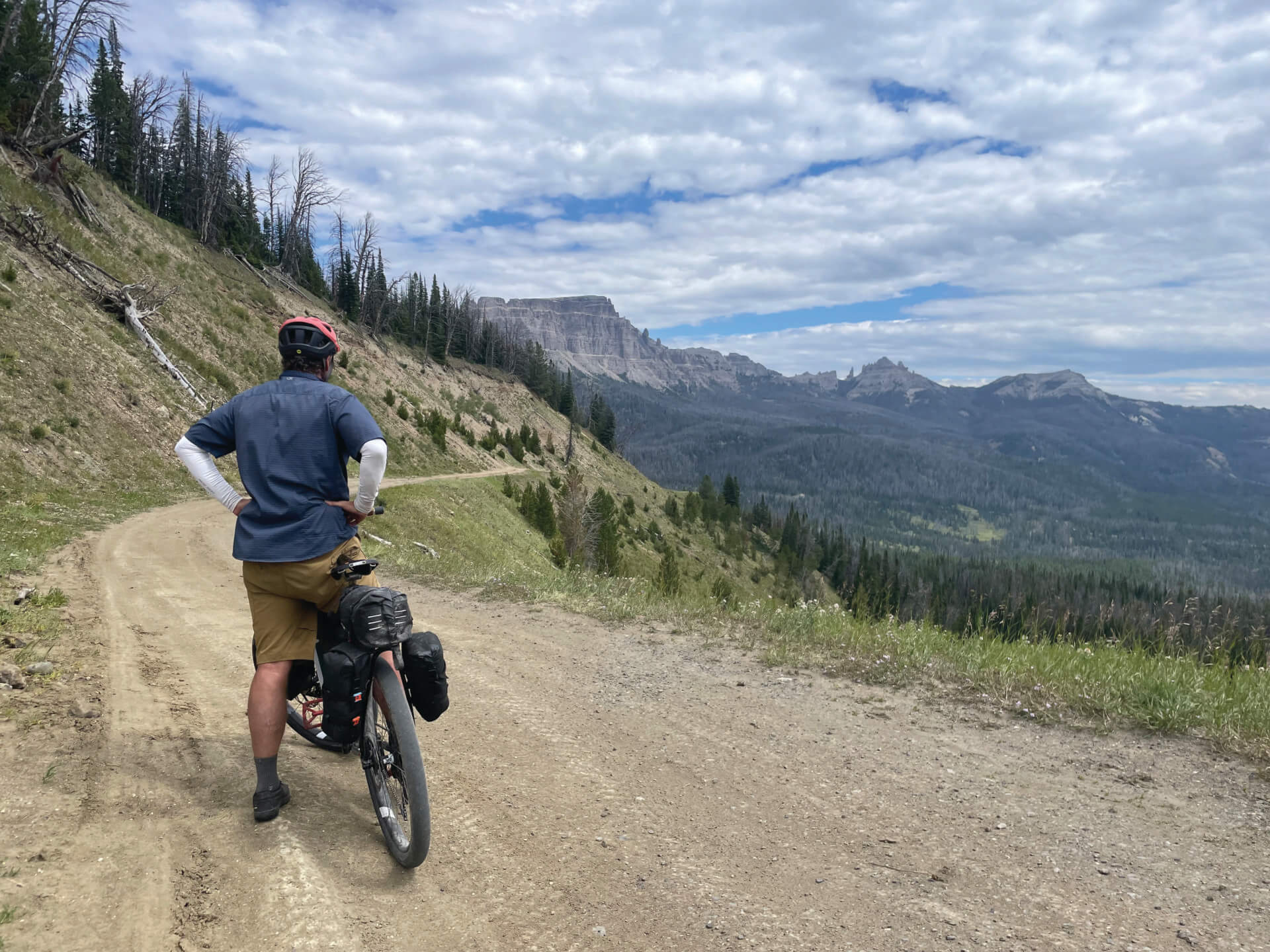
From Turpin Meadow, the dirt route climbs to Highway 26/287 and up and over Togwotee Pass. At Wind River Lake, a short detour from the highway goes to Brooks Lake. On paper, it hardly seems worth the effort, but the views are spectacular, it’s off the busy pavement, and it includes six glorious miles of downhill.
On the eastern side of Togwotee Pass, the GDMBR leaves the highway to ascend through subalpine wildflower meadows to Union Pass, where the Wind River, Absaroka, and Gros Ventre Mountains converge. The climb up Union Pass, the ninth place the GDMBR crosses the Continental Divide since Banff, has some frustrating ups and downs, an abundance of cows, and loose, cobbly road surfaces before it descends for good into the Upper Green River Basin. JH