Read The
Current Issue
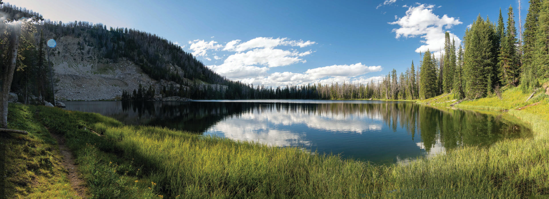
Walk to Water
These lakes and creeks are worth the effort it takes to hike to them.
// words and photos By dina mishev
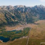
There are 44 named lakes (and an uncountable number of unnamed lakes) in Grand Teton National Park. Yellowstone National Park has more than 600 lakes. The Wind River Mountains, just one of the six mountain ranges in the 3.4 million-acre Bridger-Teton National Forest that surrounds Jackson Hole, are home to more than 1,300 named lakes. And then there are the rivers, creeks, and streams in and around the valley. Add the length of these together, and you’ve got more than 2,000 miles of flowing water, including the Snake River and its headwaters. Add the shorelines of this waterfront together, and the Greater Yellowstone Ecosystem, of which Jackson Hole is part, has fewer miles of shoreline (not to be confused with coastline) than Florida (8,436 miles) and Louisiana (7,721 miles), but a smidge more than Maryland (3,190 miles) and Michigan (3,224 miles).
Here are some favorite Jackson Hole hikes to, or along, water.
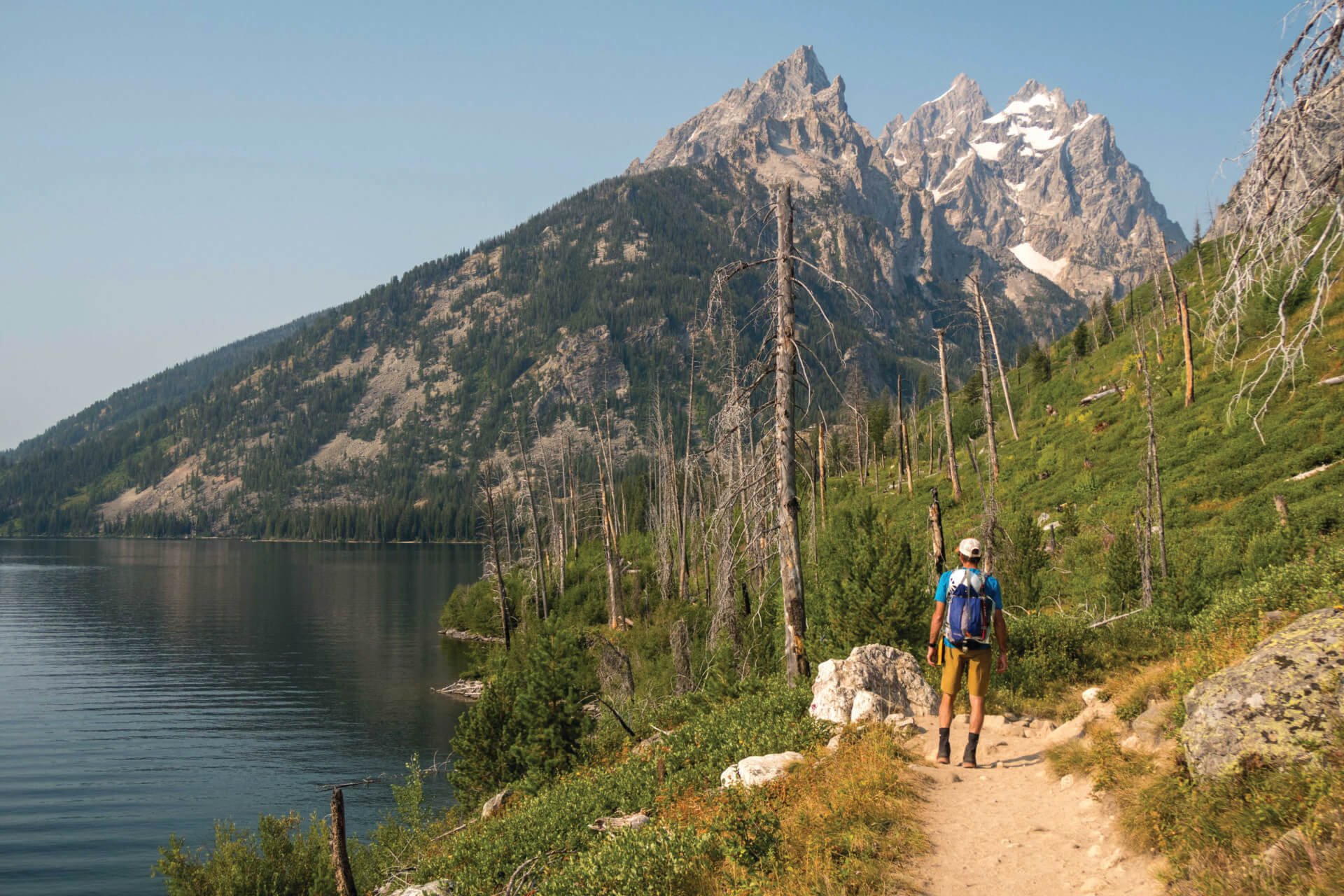
Full disclosure: I have a soft spot for Lake Solitude, in the flats below a ring of cliffs at the back of the North Fork of Cascade Canyon in Grand Teton National Park, because a photo of my then-boyfriend-now-husband and I hiking along its shore once graced the cover of Backpacker magazine (seen to the right). And more disclosure: while you can hike from the western shore of Jenny Lake to Lake Solitude and back (14.4 miles with 2,670 feet of vertical gain), if you are acclimatized and have the fitness, I recommend visiting Lake Solitude as part of the 20-mile loop that links Paintbrush Canyon to the North Fork of Cascade. Either way you get to Lake Solitude, though, you should stop at the lake and soak your feet.
The loop is significantly more difficult than the out-and-back—it’s 4,430 feet of vertical gain versus the out-and-back route’s 2,670 feet—but, as pretty as Lake Solitude is reflecting the Cathedral Group, the views of it as you descend to it from 10,700-foot-high Paintbrush Divide are even prettier. Also, I think Paintbrush Canyon is one of the prettiest canyons in the Tetons.
You can do the loop clockwise or counter-clockwise, depending on whether you’d prefer to hike up or down the steepest part, which is in Paintbrush Canyon. To hike up the steep, go counter-clockwise—start by hiking up Paintbrush Canyon; if you’d rather hike down the steepest sections, go clockwise, and start the loop by hiking up Cascade Canyon. If you’re not up for a 20-mile day hike, you can do the Paintbrush-Cascade Loop as a one-night backpacking trip (get a GTNP backcountry permit for the Upper Paintbrush Canyon Camping Zone or the Cascade Canyon North Fork Camping Zone). Dogs are not allowed on trails in Grand Teton National Park
For about the last decade, the most difficult part of the three-mile hike up 1,400 feet to Goodwin Lake, at 9,500 feet just below the north side of Jackson Peak in the Bridger-Teton National Forest, has been the last mile of dirt road to its trailhead. Its ruts, runnels, exposed rocks, and potholes have been impassable for the last several years by anything but trucks and SUVs with substantial clearance. (Don’t think your Toyota RAV4, Honda CR-V, or Nissan Rogue crossover SUV can make it.) This effectively makes the hike one mile longer in each direction, but this summer, the BTNF plans to rework the road, trailhead, and trail itself, perhaps even moving the trailhead down to where the road has been going to s&^% for the last 10-plus years.
Goodwin Lake is both a gorgeous day hike and a lovely place to backpack.
Even though at the time of writing this story, we’re not sure where exactly the trail to Goodwin Lake will start this summer, this hike is worth it. It is both a gorgeous day hike and a lovely place to backpack. Trying to think of another backcountry lake that is as easy (relatively speaking) to hike to, I come up blank. Also, because Goodwin Lake is in the BTNF, it doesn’t require the advance reservations necessary for camping in the backcountry of GTNP; in fact, it doesn’t require any reservations. But there are only three official campsites there, and if you arrive late, they might already be taken.
The official trail to Goodwin Lake goes along the lake’s north side, but there is an obvious path on the south side so that you can walk around the lake (this takes about 10 minutes). If you fancy a dip in the lake, try the southern shore, where you can walk out into deep water on rocks instead of mucking through the silt that dominates much of the northern shore.
In addition to three designated campsites, there are several areas marked for day-use. These are right on the lake and make a perfect daytime base camp if you want to settle in and enjoy a day at the lake. Please don’t camp at these sites, though. One of the seven principles of Leave No Trace includes camping at least 200 feet from any water. This is to protect habitat and also so that when you stumble out of your tent to pee in the middle of the night, you’re not doing that right at the water’s edge.
Dogs are allowed at Goodwin Lake (it’s in the national forest, not the national park), but owners should be aware that there is no water along the trail, and the first mile can be hot and dry. Get to the trailhead by taking the Elk Refuge Road to Curtis Canyon Road. About 4.2 miles from the start of Curtis Canyon Road, there’s a fork. Stay right. Depending on the summer construction, parking might be in this area. Please don’t just pull into the sagebrush; instead, look for a hardened, previously parked-on spot.
One of the six lakes that were formed by glaciers at the foot of the Tetons, Jenny Lake is the single most visited spot in Grand Teton National Park. Any hike you do here—the 5.8-mile full circumnavigation of the lake or taking the Jenny Lake Boat Shuttle (read more on page 42) from South Jenny Lake to the 1,191-acre lake’s western shore and then hiking back (two or four miles depending on whether you go clockwise or counter-clockwise)—will be busy, but Jenny Lake is rightfully popular. Hiking along its eastern shore when the wind isn’t making waves on the lake, you’ll see Teewinot Mountain reflected in Jenny’s sapphire blue waters. Hike the wilder western shore and you might run into moose, black or grizzly bears (it’s recommended to carry bear spray—and know how to use it—on any hike you do in Jackson Hole), and osprey. At the north end of the western shore, the trail goes through the burn scar of the 1999 Alder Fire, which was started by a lightning strike and almost burned historic Jenny Lake Lodge.
Any hike at Jenny Lake can include a dip in the lake. The best and easiest place to do this is on the eastern shore, just north of the boat dock. Dogs, even on leashes, are not allowed on trails in Grand Teton National Park.
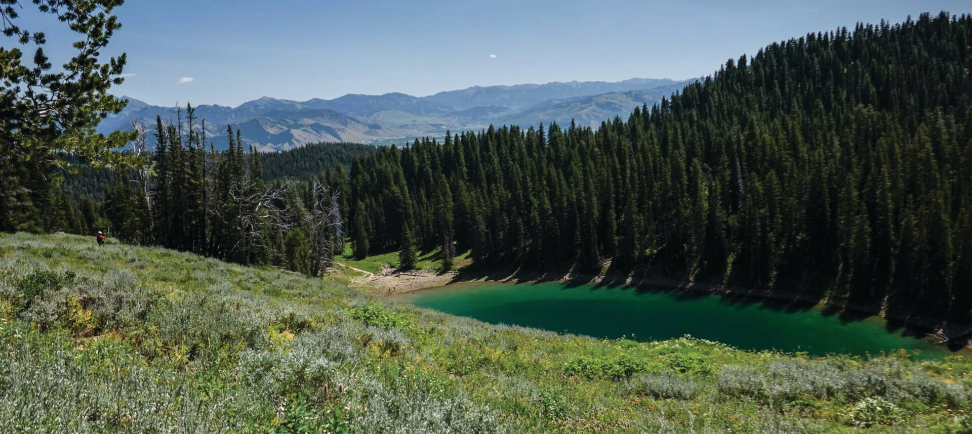
Ski Lake might be the easiest of the many gorgeous alpine lakes in and around Jackson Hole to hike to. Starting at the Phillips Pass Trailhead on the north side of Wyoming Highway 22 several miles above the community of Wilson, it’s two miles and 800 feet of vertical gain to the lake, and you might spot a moose along the way. Do this hike, which is in the Bridger-Teton National Forest, between mid- and late July, and you’ll see the wildflowers along the way—arrowleaf balsamroot, sticky geranium, and Indian paintbrush, among others—at their peak.
Tucked into an amphitheater at 8,650 feet, Ski Lake does not offer sweeping views, but it is a favorite with locals, especially ones with fur kids. Dogs love the hike to Ski Lake because there’s not only a lake to jump into at the end, but there’s also water along most of the trail.

“Anywhere else this would be a national park,” my friend said the first time I took her hiking up Cache Creek, a much-loved locals’ spot where the Bridger-Teton National Forest is only 1.5 miles from Jackson’s Town Square. A network of singletrack trails here cuts across the hillsides above and opposite the creek, which looks (it’s crystal clear) and sounds (it burbles) exactly like what you expect of a mountain creek. Closest to the burbling is what used to be a forest service road, now decommissioned and wide enough to walk three or four abreast. The further you get from the trailhead, which is at the end of Cache Creek Drive in East Jackson, the narrower the former road gets and the fewer people you’ll see (expect to see a couple of dozen other hikers/runners/mountain bikers the first mile or two). If you were so inclined, you could enter the BTNF at Cache Creek and walk pretty much all the way into and through Yellowstone National Park.
Most people are happy with a mile or two, though. (The old Cache Creek Road actually has small signs marking miles 1, 2, and 3.) If you’ve had enough burbling and don’t want to retrace your steps, there are spur trails that connect to the hillside trails on both side of the old road every half-mile or so. If you hop onto one of these, as long as you follow it down the canyon you’ll eventually end back at the trailhead parking lot.
Cache Creek sometimes has more dogs on it than humans; if your dog is anxious or shy, this might not be the best hike for him/her. Please respect the mandatory leash zone in and around the trailhead. There are Mutt-Mitt stations in the parking lot and the first several hundred feet of the former road.

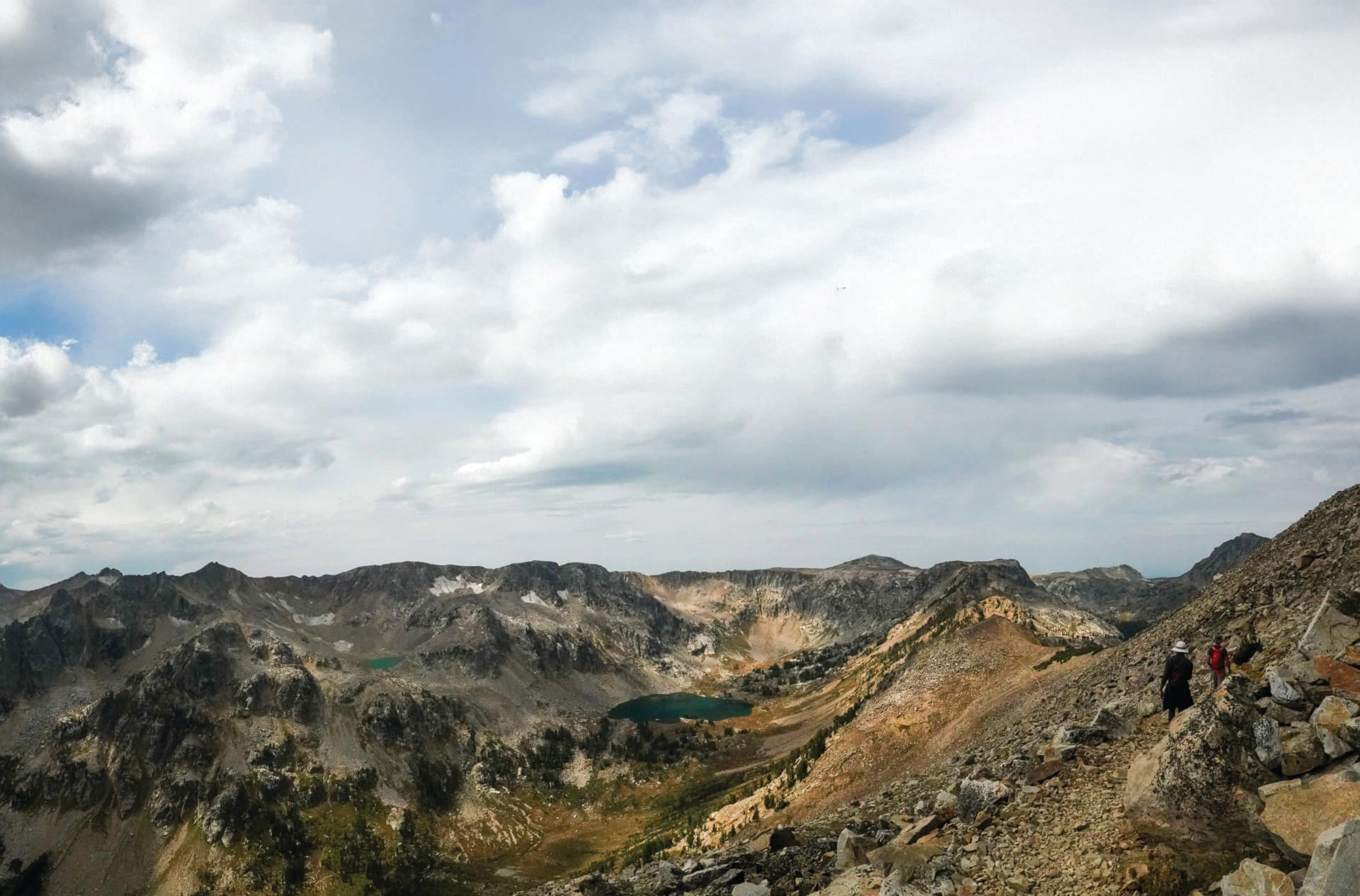
Few places in Grand Teton National Park are as aptly named as Hanging Canyon, sandwiched into a fissure above the western shore of Jenny Lake between the much larger Cascade and Paintbrush Canyons. And if there is a lake anywhere in Wyoming with a name as much Anne-of-Green-Gables-meets-Lord-of-the-Rings as the lake tucked into the back of this canyon at 9,565 feet in elevation, Lake of the Crags, I haven’t heard of it.
There is no maintained trail into Hanging Canyon, which makes it all the more important for you to stay on the unofficial-but-obvious trail rather than setting your own route and tromping on the canyon’s lush vegetation. It’s five miles (one-way) up about 3,000 vertical feet to Lake of the Crags; expect to hop over some deadfall, especially in the first 1,000 feet. Above the deadfall zone, you’ll pass Arrowhead Pool and Ramshead Lake. While you might be tempted to end your hike at Ramshead Lake, don’t. The effort of climbing another 500 vertical feet to Lake of the Crags is one thousand percent worth it. The lake is snuggled into talus fields beneath snaggly pinnacles with names like Symmetry Spire, Rock of Ages, and The Jaw.
The effort of climbing another 500 vertical feet to Lake of the Crags from Ramshead Lake is one thousand percent worth it.
If I want to take a dip, I usually do it at the eastern end of the lake. If I want to take a nap, I’ve both set up a hammock in whitebark pine trees at the eastern end and also spread out my Z-rest pad in a patch of grass at the western end.
Because the Hanging Canyon trail is unofficial, it is not on maps. It starts from the western shore of Jenny Lake. From the easternmost String Lake Trailhead parking area, hike south along the western shore of Jenny Lake, following signs for the Jenny Lake west boat dock and Cascade Canyon. You will cross three wooden bridges. The third one has a little step down. You’ll see a fourth bridge about 150 feet ahead. If you cross that bridge, you’ve gone too far. Between the step-down bridge and the fourth bridge, there’s a sizable dead tree on your right (west). Just north of the tree’s base, there’s a semi-circle of rocks. Look up from the rocks and you’ll see the trail that will take you up Hanging Canyon. JH