Read The
Current Issue
Snow Science
The job of an avalanche forecaster isn’t all sunshine and powder— they’re charged with nothing less than keeping the skiing and driving public safe.
// BY billy arnold
// photography by bradly J. boner
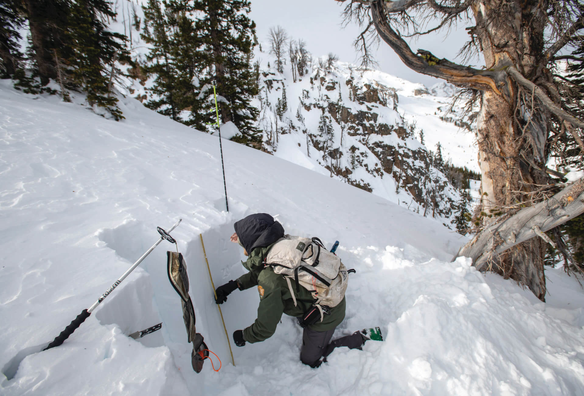
Frank Carus zips his jacket, snaps his ski boots into his skis, and looks up at Wimpy’s Knob, a lumpy, easterly face in Grand Teton National Park beloved by backcountry skiers—the adventurous powder-hounds that prefer to make their turns far from ski lifts, in terrain they must first climb before descending and where there is no ski patrol to help if things go awry.
But, on this February morning, Carus isn’t here to ski powder, though making a few choice turns will certainly be part of his itinerary. Rather, as the director of the Bridger-Teton Avalanche Center, a U.S. Forest Service operation, he is trying to find the balance between good skiing, safe skiing, and skiing that will tell him something worthwhile about the snow’s stability across the eastern side of the Tetons. He wants to get close enough to avalanche-prone slopes that he can study them, evaluate how they look on the surface, and better understand how they will react if humans cut into the snow that covers them with skis or snowboards, but not so close that he causes an avalanche. The goal is to identify hazards and communicate the risk of skiing in wild snow to the general public.
Carus is one of about a dozen people spread across the valley’s guiding operations, ski resorts, and transportation departments tasked with studying snow to keep people safe when they’re skiing—and driving. Another one is Jessica Baker, an avalanche forecaster for Exum Mountain Guides and Jackson Hole Mountain Resort’s backcountry guide service. “Lives are at stake,” Baker says. “My job as a forecaster is to create the most simple but precise synopsis of what is going on out there for people.”
Avalanches are dangerous. They can move up to 80 miles an hour, and then, once they stop, consolidate into a jumble as dense as concrete. On average, avalanches, colloquially called “slides,” kill about two people every winter in Jackson Hole; nationwide about 27 people die annually in avalanches. Most of these deaths are folks recreating in the backcountry—skiers, snowboarders, and snowmobilers—but drivers on mountain passes, like Teton Pass, are also at risk. Nationally, 13 motorists have died in avalanches since 1951, the year the state-run Colorado Avalanche Information Center started keeping track.
Slides don’t come out of nowhere. Like the most menacing cookie your grandmother ever made, they have a recipe. Their main ingredients are a slope of sufficient steepness (usually at least 30 degrees, which, for reference, is comparable to the angle of a typical set of stairs), a load heavy enough to push it downhill, a trigger, and a surface to slide on. The trigger can be a skier or snowmobiler, or a purposeful detonation of an explosive by ski patrol. Forecasters call the sliding surface a “weak layer.”
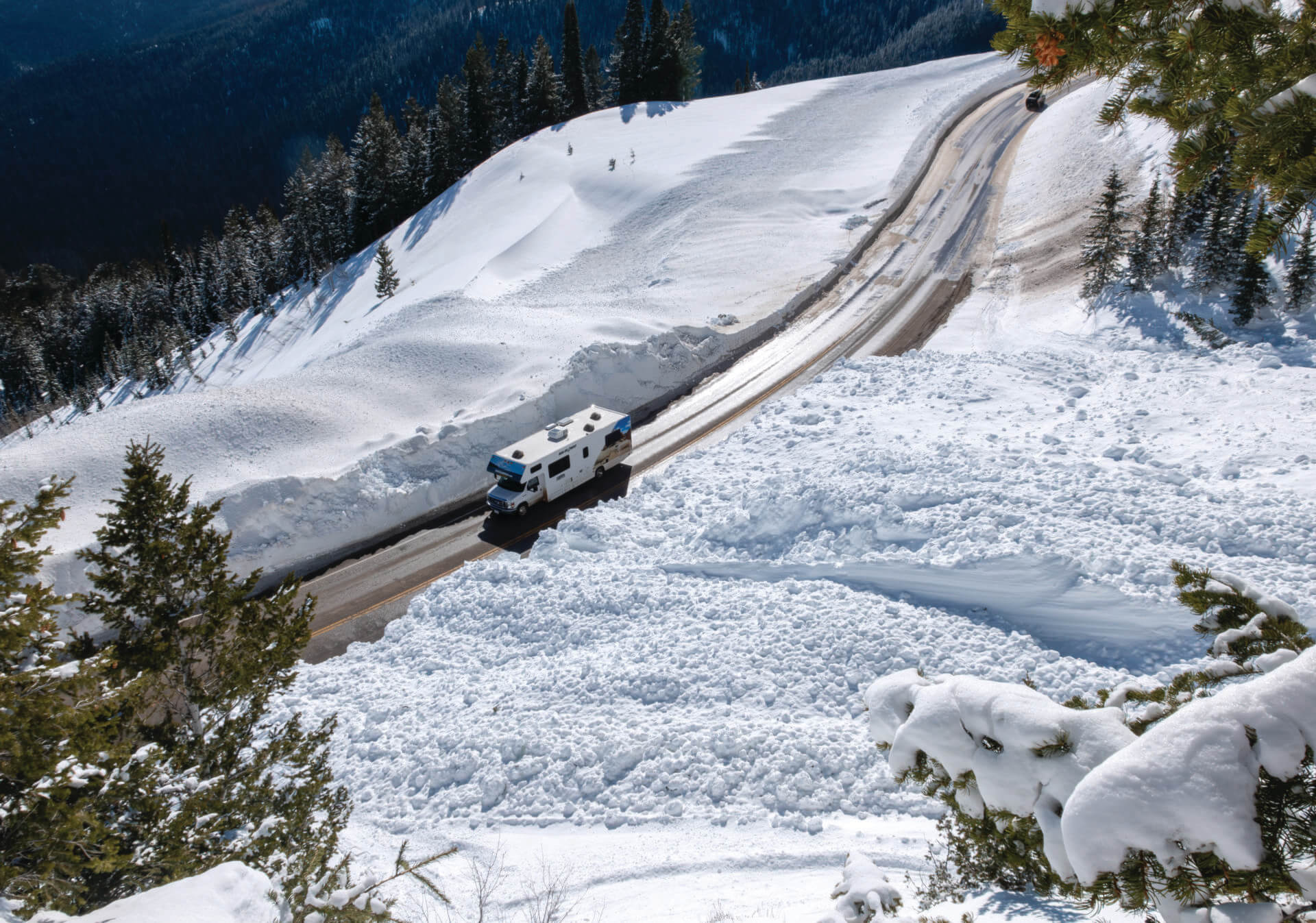
Once triggered, an avalanche can send literal tons of snow downhill—more than enough to bury Highway 22 and/or catch and carry a skier, pinwheeling them off trees and other obstacles as they fall. At best, someone caught in a slide is located and dug out. At worst they’re buried under feet of densely packed snow and aren’t located before they asphyxiate and die. (According to the American Avalanche Association, chances of survival are 92 percent for avalanche victims extricated within 15 minutes; chances of survival decrease to 37 percent after 35 minutes of burial. This is assuming they weren’t killed by trauma sustained during the slide.)
Avalanche forecasters are tasked with understanding when and where slides are likely and then sharing this information so that recreationalists can avoid them and so that ski resorts and departments of transportation can perform avalanche-mitigation work, which involves using dynamite and other explosives or blasts of air to cause avalanches before they unexpectedly catch drivers or skiers.
“Lives are at stake. The most basic form of this is that you could either live or die in the mountains that day.”
—Jessica Baker, Exum mountain guides forecaster
North Americans—Canadians, specifically—realized the value of avalanche forecasting in the early 1960s. In 1962, Parks Canada established the Snow Research and Avalanche Warning Section to protect a treacherous 24-mile stretch of the Trans-Canada highway over Rogers Pass; this was the first major avalanche-forecasting operation in North America. Today in the U.S., 14 state departments of transportation, including the Wyoming Department of Transportation, have avalanche forecasters. Additionally, the U.S. Forest Service operates a network of 14 backcountry avalanche centers to communicate avalanche risk to backcountry users; these are all overseen by the National Avalanche Center. Jackson Hole ski/snowboard guiding services, including Exum and Jackson Hole Mountain Guides, have their own teams of forecasters. So do most ski resorts in the western United States. (Ski resorts without their own in-house team collaborate closely with Forest Service forecasters to direct their avalanche mitigation.)
Different forecasters have different end goals: WYDOT forecasters work to allow plow drivers and civilians to cross Teton Pass safely; JHMR forecasters help ski patrollers decide when and where to place bombs for avalanche mitigation; Exum and JHMG forecasters give their guides the information to safely take clients through the mountains; the Bridger-Teton Avalanche Center informs the public about the risks of heading into the mountains.
All forecasters are in the information business. They need to learn about hazards and communicate them to plow drivers, ski patrollers, guides, and the public. Guides do this via a spreadsheet that’s discussed in a pre-dawn Zoom call. For JHMR, it’s a list of avalanche paths for patrollers to check. For the BTAC, it’s a bulletin with an avalanche-danger rating, an explanation of the rating, and a discussion of uncertainty. The bulletin publishes online, between 5 and 7 a.m., for four different forecast zones covering 7,000 square miles.
“I was always fascinated by the mechanics of avalanches as well as the difficulty of predicting them. It’s such an inexact science that it’s intriguing to me.”
—JHMR and BTAC Forecaster Mike Rheam
Forecasters like Mike Rheam, who splits his time between forecasting for JHMR’s ski patrollers and the BTAC, have to communicate the science to two very different user groups. “We remind ourselves on the public side that although we have a lot of savvy, well-educated users, we also have travelers who aren’t very familiar with avalanche country,” he says. “The ski area is different—we’re talking trained, professional avalanche mitigators that get this messaging every day, and we are very specific about our weather observations.”
For WYDOT, the messaging is targeted and localized. In the local WYDOT zone, there are 15 slide paths above Teton Pass and about 30 others total above the Hoback River Canyon (U.S. Highway 191/189) and Snake River Canyon (U.S. Highway 89). Don Lawless, WYDOT’s avalanche supervisor, thinks about keeping the public safe, but before that, keeping his plow drivers safe. On mornings when Lawless and his forecasting team close Teton Pass or either canyon to perform avalanche mitigation work, plow drivers often have to drive below the paths to clear the road for the mitigation crew, which can be dangerous. Since 1951, avalanches have killed 14 highway personnel in the U.S. While no DOT workers have died in the Teton area, a WYDOT driver was buried in his plow in 1988 when Glory Bowl slid.
For the most part, avalanche-forecasting programs have been successful. Since 1970, when state DOTs started avalanche programs, only four motorists have died in avalanches in the U.S. Today at ski resorts, avalanches kill fewer than one inbound skier/rider per year on average. While avalanches annually kill an average of 18 backcountry users, forecasters see what they’re doing as a success. In the last 10 years, more and more people have flocked into the backcountry, but avalanche deaths have flatlined if not decreased slightly. Simon Trautman, director of the National Avalanche Center, says about the USFS program: “It’s small, but it has this massive reach, and I think a track record that shows it’s a very big part of fatality rates flattening if not going down in the past decade. It’s not the whole story, but it’s a big part of that story.” (And it’s not that expensive to U.S. tax payers; the federal government spends about $5 million annually on the salaries of about 65 avalanche forecasters.)
In the Tetons, avalanche science started being taken seriously in the early 1970s. Backcountry skiing on Teton Pass was becoming more popular and, as part of a realignment of Highway 22 over Teton Pass, WYDOT built a bridge that spanned the lower reaches of the Glory Bowl slide path, which rises above the north side of the highway near the top of the pass. The idea was that when/if Glory slid, avalanche debris would pass beneath the bridge and not affect motorists or the road. But, in 1970, Glory slid, and instead of the debris passing beneath the bridge, it took the bridge out. The next year, 1971, WYDOT started avalanche forecasting for Teton Pass (and had given up on the idea of a bridge).
At the same time, avalanche pros at Jackson Hole Mountain Resort (then Jackson Hole Ski Corp.), U.S. Forest Service snow rangers that used military-grade artillery to blast unstable slopes, realized the work they were doing could benefit people outside of its boundaries. In 1976, after a slew of deaths in the backcountry of the Tetons, snow ranger Gary Poulson recorded the first phone bulletin about local avalanche conditions. People who called the line heard a message about snowfall, snow depths, weather, and, crucially, an avalanche-hazard rating.
Fast forward 50 years, and the number of people who engage with avalanche terrain in Teton County has only grown. About 7,500 cars now commute daily over Teton Pass, and backcountry skiing has exploded in popularity. From the 1930s to the ’70s, Jackson Hole’s backcountry culture was centered around a few oddballs making turns in jeans and wool sweaters on Teton Pass. Now, skiers and snowboarders track over 100,000 ski runs just on Teton Pass every winter. The figures for backcountry runs in Grand Teton National Park and the mountain ranges south of the valley are lower but still exponentially higher than they were even two decades ago.
While avalanche forecasting in the Tetons has grown, the number of forecasters is still small. WYDOT has two full-time forecasters and two seasonal workers. JHMR’s forecasters split time between the ski hill and the BTAC, which hires about six staff each winter. Guide services like Exum also have forecasters of their own.
Forecasters follow both what’s happening on the ground and in the atmosphere to create an evolving picture of the snowpack. They meticulously follow data from weather stations and also venture into the field to ski and dig around in the snow to better understand how weather is impacting the snowpack’s stability, which will differ depending on aspect and elevation.
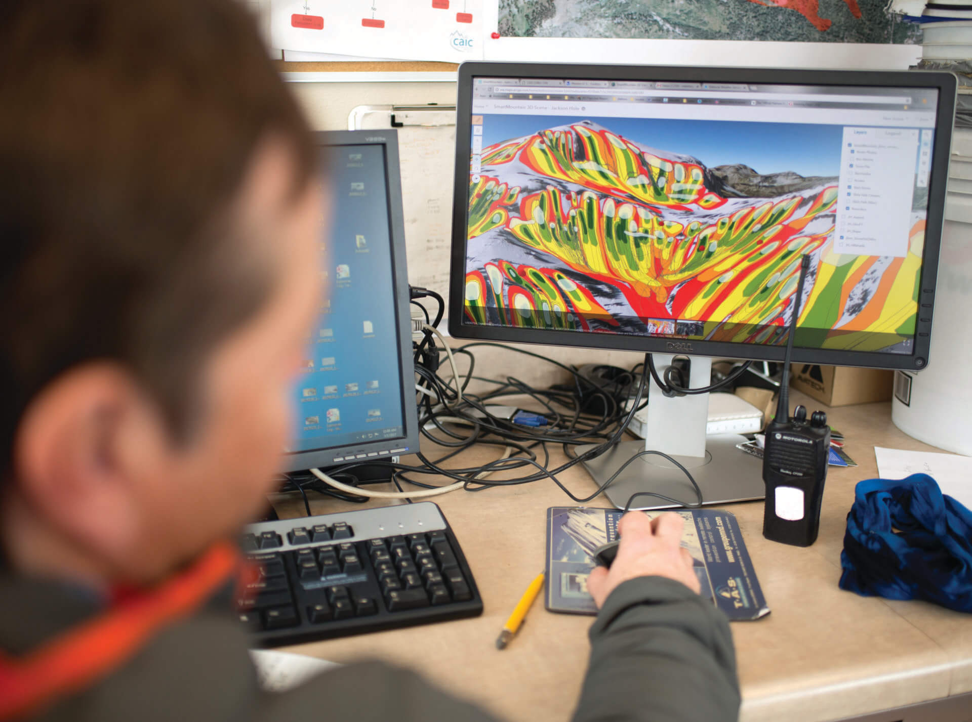
Being a forecaster means committing to early mornings that start around 4 a.m. “A typical morning when I’m forecasting starts with a cup of coffee for sure,” says Baker. When she gets up that early, a few hours before other Exum guides rise and join her on Zoom for their daily conditions call, Baker combs through weather data from the night before to see how much snow fell and where. She then looks at the weather forecast for the day to try to figure out where destabilizing weight might come from—wind moving snow onto an unstable slope or new snow falling. This all happens at home, in front of a computer. Then, as forecasters venture out into the backcountry or JHMR, they check their hypotheses against what they’re seeing on the ground.
“I was always fascinated by the mechanics of avalanches as well as the difficulty of predicting them. It’s such an inexact science that it’s intriguing to me.”
—JHMR and BTAC Forecaster Mike Rheam
But the science is inexact. Forecasters rely on data from discrete points—a weather station, a pit in the snowpack, or an observation of a naturally triggered avalanche—to estimate how dangerous avalanche conditions are across a larger area. The science of snow stability is also a bit of an art. Forecasters communicate what they can but also rely on backcountry skiers to have some education of their own, so they, like guides and forecasters, can develop hypotheses before they venture into the backcountry and test them.
“Generally speaking, as a more experienced forecaster, you learn how to bring enough range in your communication where people have to think a little bit,” says Baker. “They can’t just be like, ‘Jessica says to ski Glory Bowl’.” Instead, skiers and guides have to think about the forecast and decide what’s best, given the conditions and their risk tolerances.
To hedge against uncertainty, forecasters talk with one another, and with other snow professionals. When Baker has a question, she calls Rheam. Exum and JHMG guides invite the BTAC forecasters into their morning meetings. WYDOT forecasters, who often patrol Teton Pass at 2 or 3 a.m., give later-rising forecasters a heads up, which is sometimes a summary of what slid and what didn’t.
“We can provide information to the [JHMR] avalanche team, the [BTAC] team, and then another group chat that has all forecasters in the valley,” Lawless says. “Whatever information we pick up that we feel is relevant to other people, we send out a photo, a description. That line of communication has definitely gotten better over the years.” Forecasters, who themselves can only visit a few zones in the backcountry a week, have also started asking the public to share what they see. BTAC has an easy way for everyday backcountry users to submit their observations—snowpits they’ve dug, pictures of natural avalanches, reports of near misses, and general observations about the snowpack. “If you’re looking at 50 to 60 observations in that same time period over many different drainages, your confidence is quite high on the information you’re delivering,” Rheam says.
But even though forecasters and skiers share data, a big part of forecasting is still getting out into the mountains. That’s what brought Carus to Wimpy’s Knob, the popular backcountry peak in GTNP, last February. He spent the better part of a day studying, and skiing, it. He dug into the snow, used binoculars to scour neighboring peaks for signs of avalanche activity, and skied close to avalanche-prone slopes, but not so close that he’d get caught in an avalanche himself. It’s a delicate balance to keep the public informed and safe.
Meet the forecasters
Mike Rheam | JHMR
Forecasting since: The mid-90s
Getting started: After graduating from the University of Vermont with a degree in mechanical engineering, Rheam joined the Jackson Hole Mountain Resort ski patrol. As a patroller, he took snow science courses, which led the Bridger-Teton Avalanche Center to hire him in 1997. Now, he’s the avalanche program supervisor for JHMR, a forecaster for BTAC, and the lead forecaster for Tordrillo Mountain Lodge, a heli-skiing operation in Alaska.
Why? “I was always fascinated by the mechanics of avalanches as well as the difficulty of predicting them. It’s such an inexact science that it’s intriguing to me.”
Don Lawless | WYDOT
Forecasting since: 2007
Getting started: A WYDOT engineer who liked to ski, Lawless took advantage of downtime in the winter to help out with the avalanche program starting in 2007. Over a decade-and-a-half, he developed expertise and was hired as the department’s avalanche supervisor in 2022.
Why? “I do it because it’s rewarding work for me. Each day is different and the avalanche program is a really unique part of the WYDOT organization.”
Jessica Baker | Exum
Forecasting since: 2015
Getting started: Baker worked with forecasters throughout her career as a ski guide, and got her first forecasting job in Alaska, then with JHMR’s backcountry guides, and finally with Exum Mountain Guides.
Why? “I love putting all the pieces together, really taking in the full view, and then disseminating the most important info for those working in the field. I also love the process of helping facilitate important conversations each morning, engaging the guides, helping everyone stay sharp for their day in the field.”
Frank Carus | BTAC director
Forecasting since: 2010
Getting started: Carus got into forecasting through ski guiding, when he obtained a certification through the American Mountain Guides Association. He was a snow ranger in New Hampshire’s White Mountain National Forest and then a director of the Mount Washington Avalanche Center. He was hired as director of the Bridger-Teton Avalanche Center in 2021.
Why? “Avalanches are a really fascinating natural phenomenon to me, on par with wildfires.” JH
