Read The
Current Issue

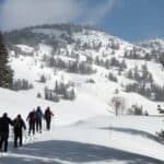
Getting High
Mountain summits for all fitness levels
By Geraldine stal
HUNDREDS OF LADYBUGS crawl on the rocks and boulders beneath my feet. Thousands flit about in the air in front of me, an ultramarine sky upping the degree of clarity of the pencil eraser-size bugs’ vermilion wings. Several dozen ladybugs are on me—on my shorts, on my bare arms, and, a companion tells me, in my hair. If this were a swarm of any insect other than a ladybug, I’d be freaking out; I’d be running down the hummocky summit block of Static Peak before enjoying the wondrous views, the feeling of accomplishment that comes from getting to the top of something, and the satisfaction of resting after several hours of strenuous exercise. And if the bugs weren’t ladybugs, I wouldn’t stay on top long enough to enjoy my lunch of an almond butter/Nutella/banana sandwich.
But they are ladybugs, so giddily and in awe I find a seat on one of the summit’s flatter boulders. And then I enjoy all of the above, and also enjoy being in the middle of a swarm of ladybugs. Who am I to disagree when the universe decides that lunching on the summit of a mountain where views stretch into three states and where, on every spot not covered by a boulder, unexpected clumps of cheerful, dime-sized yellow and purple flowers aren’t amazing enough on their own?
Since this day on the summit of 11,302-foot Static Peak, situated between Death and Avalanche canyons south of the highest peaks in Grand Teton National Park, I have not again seen a ladybug swarm. I have stood on dozens and dozens of other summits and even returned to Static looking for them. Still, even sans ladybugs, each summit has been exhilarating and magical.
While it is the valley’s highest summits—read: most difficult and demanding to get to—that get the glory, here are five summits that, although easier to attain than the Grand Teton, can be just as exciting. Two you can even reach by a lift or tram. We’ve given each a difficulty rating that is relative only to these five adventures. All distances given are round-trip.
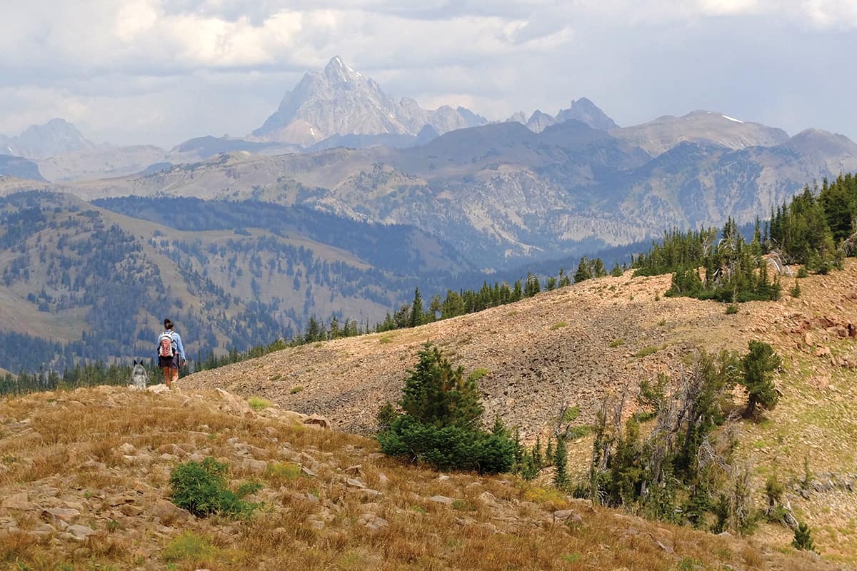
Static Peak
Distance: 16 miles and 4,000ish vertical feet
Difficulty: 10
Trailhead: Death Canyon, in Grand Teton National Park
Cost: A pass to GTNP, good for a week, is $35 per vehicle.
The trail to Static Peak is well-trod and takes you into the heart of the Tetons, passing wildflowers, small waterfalls, and a raging creek fed by snowmelt. You might even see moose or bears along the way. But on this hike, more than others, it’s important to remember that when you reach the summit, you’re only halfway done. While Static Peak is among the easternmost of the Tetons, the trail to it is circuitous, requiring you to hike west and around neighboring peaks’ backsides before switchbacking up to a saddle 800 feet below the summit. While technically no trail leads from this saddle to the top, the terrain is easy as far as off-trail travel goes, and there is a faint unofficial trail to follow.
Cool things to look for from the summit include Timberline Lake, just to the north; Jackson Lake, which you can see the entire length of; and the Wind River Mountains, home to the state’s highest peaks and biggest glaciers and about fifty miles to the east-southeast as the crow flies. Timberline Lake, at 10,312 feet above sea level, is often covered by ice into August. Admire it and then watch sail and power boats zipping around Jackson Lake.
Snow King
Distance: 0 to 2.4 miles with 1,600 feet of vertical gain
Difficulty: 1 (take the scenic chairlift) or 3 (hike one way and take the lift the other way) or 5 (hike up and down)
Trailhead: Snow King Mountain
Cost: Chairlift is $20; $15 for those 65 and up or 6–12 years old
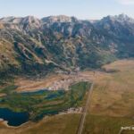
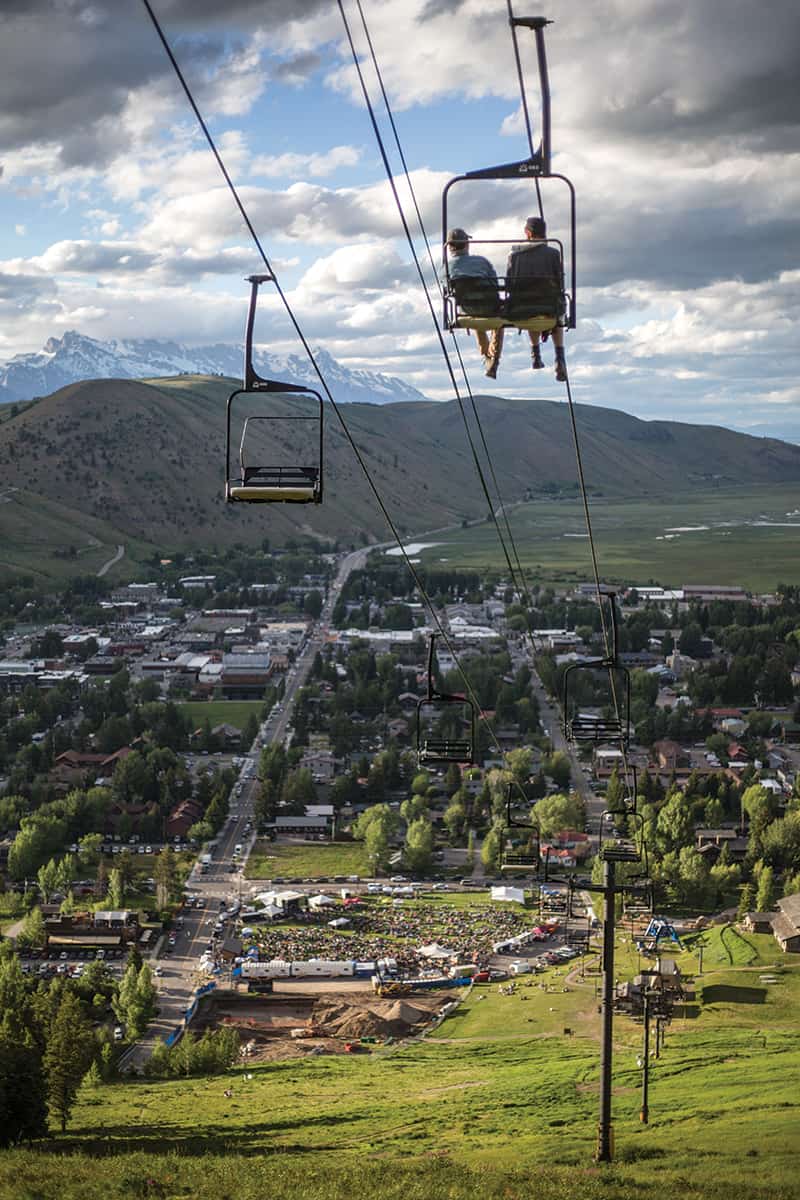
The trail up Snow King Mountain isn’t just a great workout that includes views down onto the Town of Jackson, but it’s also the heart of the valley’s summer social scene. Hundreds of locals hike up the “Town Hill” every day, often in pairs or small groups of friends. If you’re looking to experience some local flavor, this is the hike for you. It’s also the hike for you if you don’t want to actually hike but do want to stand on a summit. Daily, a double chairlift carries people from the base area to the mountain’s 7,808-foot summit.
From the top, Jackson is revealed as the most perfectly situated town ever. Its neat grid of tree-lined streets extend right up to the southern boundary of the National Elk Refuge. (FYI, elk don’t live on this refuge in the summer; in winter, however, as many as 8,000 come down from the mountains to feed.) From the Elk Refuge, it’s an open landscape all the way to the Tetons, which you can see from a viewing platform a couple of steps from the top of the chairlift. Also evident from this summit are: 1. How Jackson Hole really is a hole, surrounded by mountains, and 2. There are so many more mountains than you can see from the valley floor. Look south and east from Snow King’s summit and range after range stretch into the distance.

Rendezvous Mountain
Distance: 0 to 15.6 miles; 4,167 vertical feet
Difficulty: 1 (take the JHMR tram) or 7 (hike one way and take the tram the other way) or 9 (hike up and down)
Trailhead: Teton Village
Cost: Tram tickets from $31 (online, jacksonhole.com)
Rendezvous Mountain’s 10,450-foot summit is the most impressive one in the area you can get to without much walking. Few things but lichens, the hardiest of wildflowers, and picas, a tiny member of the rabbit family that has trouble surviving when temperatures exceed 76 degrees Fahrenheit, live here, where even in July and August it could snow. The Jackson Hole Mountain Resort tram offers an incredible opportunity to experience a full-on high alpine environment for all ages and fitness levels. On clear days you can see into three states and to the Wind River Mountains. Also, there’s a cozy hut at the top, Corbet’s Cabin, that serves made-to-order waffles, the doughy goodness of which you can smell almost as soon as you exit the tram. If you’re doing okay with the thin air up here, a “lollipop” trail, where the start and the finish sections are the same but there’s a loop in the middle, leads from the summit down into wildflower-rich Rock Springs Bowl. (Remember you’ll have to walk back up at the end!)
It’s also possible to take the tram one way and hike the Summit Trail the other. While taking the tram up and hiking down is easier on the lungs, expect your knees and quads to be sore the next day or two if you do this. Walking downhill for that long, and at steep grades, isn’t something you can easily train for. If you hike up, the tram ride down is free.
Taylor Mountain
Distance: 8.3 miles, climbing about 3,200 vertical feet
Difficulty: 7
Trailhead: Coal Creek, on the west side of Teton Pass, just before you leave Wyoming and enter Idaho
Cost: Free
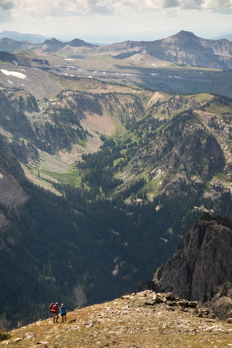
This challenging-but-doable-for-most-people hike at the southern end of the Tetons starts by winding alongside a genuine babbling brook, Coal Creek, and then passes meadows of wildflowers and stands of ancient whitebark pine trees before reaching an impressive high alpine ridge and boulder-strewn, 10,351-foot summit. (A note on whitebark pines: It is entirely possible to walk past these without realizing how amazing they are. You’ll likely notice how gnarled they are, but you likely won’t know that this species can only grow and thrive in windy areas at high elevations. Also, they’re old—some of the whitebarks on Taylor are between 500 and 1,000 years old. That “baby” whitebark about the height of your hip? It’s already around a century old.)
From the summit, which you’ll likely have to yourself, the 360-degree views take in six mountain ranges. Close by is Rendezvous Peak (not to be confused with Rendezvous Mountain, which is where the Jackson Hole Mountain Resort tram goes). In the far distance, the Grand Teton’s East Ridge and the wispy snowfields beneath its 13,775-foot summit look impossibly delicate. To the right of the Grand Teton, you can see how Teewinot Mountain, which means “many pinnacles” in the Shoshone language, got its name.
Table Mountain
Distance: 13.2 miles, climbing 4,100 vertical feet
Difficulty: 10
Trailhead: Teton Canyon, off Ski Hill Road in Teton Valley, on the west side of Teton Pass
Cost: Free
Table Mountain has some of the best views of any summit in the area—they encompass 360 degrees and include the Grand, Middle, and South Tetons, along with Alaska Basin, Hurricane Pass, and Cascade Canyon. While Table Mountain, 11,106-feet high and straddling the Jedediah Smith Wilderness and Grand Teton National Park, is rated a “10,” it is the easiest hike that gets you to a summit in the heart of the Tetons. (Teewinot Mountain and the South and Middle Tetons are technically “hikes,” but only supremely fit hikers comfortable traveling without a trail in difficult terrain should attempt them.)
Table Mountain is an ambitious but reachable goal for ordinary hikers acclimatized to the area’s elevation and carrying plenty of food, water, and layers of clothing. If you fall into this category, it could be the most beautiful hike of your life. But don’t expect to have the summit to yourself. Do fill up your water bottles in the lush meadows of wildflowers before the trail switchbacks up to the mountain’s 1.7-mile summit ridge. On this ridge water is in as short supply as shade. The ridge ends in a loose, 300-foot-tall mound of pebbles and broken boulders. Navigate this section, which is the steepest part of the hike, and you’ve gained the summit.