Read The
Current Issue
Going, Going, Gone?
Over the last 10,000 to 160,000 years, melting and receding glaciers created much of the Jackson Hole and Grand Teton National Park landscapes we know today. In thirty years, it’s likely some of the park’s glaciers will be history. Does it matter?
By Whitney Royster
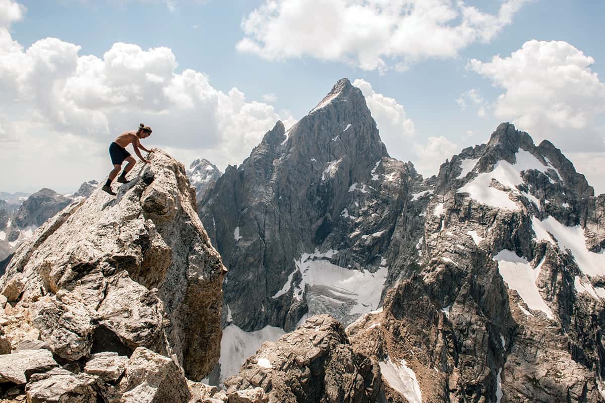
EVERY SUMMER, WHEN the snow melts and the hiking season starts in earnest, Forest Dramis likes to run to Disappointment Peak, which rises southeast of the Grand Teton.
The route to the summit takes him through coniferous forests, open fields, and, finally, high alpine terrain where little but mosses and lichens grow. From the peak’s 11,618-foot summit, Dramis, forty-three, looks out on Teepee Glacier—to the east of the Grand Teton—and, to the north, Teton Glacier. Over the eight years he’s done this, what he’s seen from Disappointment Peak’s summit has changed.
“I noticed it last summer,” Dramis says. “You can no longer see the toe of the Teton Glacier. That was kind of a stark reminder for me.”
Whatever your thoughts are on climate change, unequivocal research that started more than a century ago shows that Grand Teton National Park’s (GTNP) glaciers are shrinking. Of the park’s eleven glaciers, all have lost mass based on side-by-side comparisons of photos taken fifty years ago and current images. Quantitatively, National Park Service (NPS) researchers have found that the Middle Teton Glacier shrank by 36,000 cubic meters in 2015 and 2016. In terms of volume, that’s the equivalent of 15 Olympic-size swimming pools. In 2017, it lost another 3,000 cubic meters—far less than the prior years’ 36,000 cubic meters, but still a loss continuing the trend of glacial shrinkage.
Teepee Glacier, below the East Face of the Grand Teton, has shrunk by 60 percent in the last fifty years. This number was derived from the study of aerial photographs. Other methods of identifying and quantifying changes in a glacier’s size include Global Positioning System (GPS) elevation surveys, a type of mapping that allows researchers to see changes in relative volume, topographical surveys, and ground penetrating radar (GPR). The latter has not yet been done on any of the park’s glaciers, but GTNP physical sciences branch chief Simeon Caskey hopes to use it in the near future because it is the best way to measure a glacier’s depth.
The park’s remaining nine glaciers—Teton, Skillet, Petersen, Falling Ice, Schoolroom, the East, Middle, and West Triple glaciers, and a recently identified unnamed glacier near Glacier Peak—anecdotally and through photographic evidence are all diminishing in size.
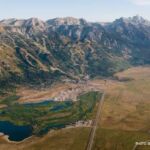
GRAND TETON NATIONAL PARK is a rugged landscape formed by glaciers. Billions of years ago, there was continental drift and collision. Hundreds of millions of years ago, magma filled cracks in the continental plates and ancient seas deposited sediment that formed limestone and shale. About 13 million years ago, further shifting of plates, a stretching of terrain, and a series of earthquakes caused the mountain range to begin rising.
Then came three periods of glaciation. The first glaciation, the most widespread and the one the least is known about, happened at a time when the valley floor was about a thousand feet higher than its current level and the present system of canyons opening onto the valley from the Tetons had yet to form. The entire area was covered in ice as thick as two thousand feet. Between approximately 160,000 and 130,000 years ago, a glacier again covered most of Jackson Hole, its southern extent just south of where the Town of Jackson is today. By about 130,000 years ago, this glacier, which featured “arms” marking the beginnings of the canyons in the Teton Range, had receded from the valley.
How glaciers form
“A glacier is just an ice mass that moves,” researcher Simeon Caskey says. “Essentially the snow is slowly transformed into ice by compression and recrystallization. Once it transforms into ice, it will actually move downhill by the force of gravity.”
As the ice moves downhill, Caskey likens it to a bulldozer or conveyor belt—the ice is scraping and dragging across the surface, picking up and depositing rocks and debris. When glaciers recede, as the Tetons’ are now, people can see the moraines, which are accumulations of dirt and rock marking the former margins of the glacier.
The most recent glaciation, occurring between 25,000 and 10,000 years ago, was when glaciers really got going on the area’s landscape. This was when Death, Granite, Garnet, and Cascade Canyons were carved and Leigh, String, Jenny, Bradley, Taggart, Phelps, and Jackson Lakes were formed as we know them today. Again though, these glaciers melted. The eleven glaciers in the park today date to much more recent (relatively) times: a neoglaciation period approximately 600 to 700 years ago.
EIGHT OF THE Lower 48 states have glaciers. Of those, Wyoming has the third most; only Washington and Montana have more. The other states are Oregon, California, Nevada, Colorado, and Idaho. Within Wyoming, the Tetons have fewer glaciers than the Wind River Range, which has about forty peaks higher than 13,000 feet and twenty-five named glaciers. The Bighorn Mountains in north-central Wyoming have one glacier, and the Absaroka Range northeast of Jackson Hole claims two.
Throughout the West, glaciers are retreating. At best, a handful are tenuously classified as “active.” An active glacier is defined not by its gaining volume but by its movement, such as developing crevasses or calving. If any of the active glaciers in the West are gaining volume in addition to moving, it is in amounts too small to be measured. In Montana’s Glacier National Park, the NPS website says that glacier recession models indicate the park will be without any active glaciers by 2030.
GTNP researchers think the same could be true for their park. Studies performed here indicate all the glaciers in Grand Teton are losing volume, but some are still moving and, hence, are active. GTNP’s active glaciers include the Teton, Middle Teton, and Falling Ice glaciers. Others, like Teepee and Petersen Glaciers, park researchers say are “probably not” moving anymore.
Terminology
Glacier: A slow-moving mass of ice formed by accumulation and compaction of snow.
Permanent snowfield: Accumulation of snow that doesn’t totally melt in summer. This can turn into a glacier if snow compacts to ice and begins moving. Sometimes called a “young glacier.”
Temporary snowfield: A snowfield that, by the end of summer, has totally melted.
Ablation zone: The area(s) of a glacier that are typically, but not always, near its toe and which melt, reducing the glacier’s size.
Accumulation zone: The area(s) of a glacier where snow and ice build, increasing the glacier’s size.
Equilibrium zone: Where accumulation and ablation balance—a rising equilibrium line means a glacier is receding.
Active glacier: A glacier that is moving.
Dead glacier: A glacier that is no longer moving.
IN 2017, CASKEY was hired as GTNP’s physical sciences branch chief, a lengthy title that means he’s responsible for researching the park’s geology, air quality, and hydrology (glaciers fall under the final category). He’s the first to hold that title, but not the first to undertake such work. Caskey came to GTNP after working as a hydrologist in Lander for the Shoshone National Forest. Before that, he worked in Laramie as a district hydrologist for the Medicine Bow National Forest. Caskey was born in Alaska, grew up in Michigan, and earned a Master of Science degree from Colorado State University in geosciences. While in Fort Collins, he traveled to Wyoming frequently for study and recreation.
Tall, fit, and thoughtful, Caskey rattles off the names of all the park’s glaciers, their aspect (the directions they face), the canyons they tower over, and the peaks they lie below. He has a particularly soft spot for Schoolroom Glacier, located at the base of Hurricane Pass at the top of the South Fork of Cascade Canyon. “It has a different geographic location, and feel and presence, to it than the others in these alpine cirques,” he says. Surrounded by spectacular scenery, Schoolroom encompasses panoramic views of the Tetons and west into Teton Valley, Idaho.
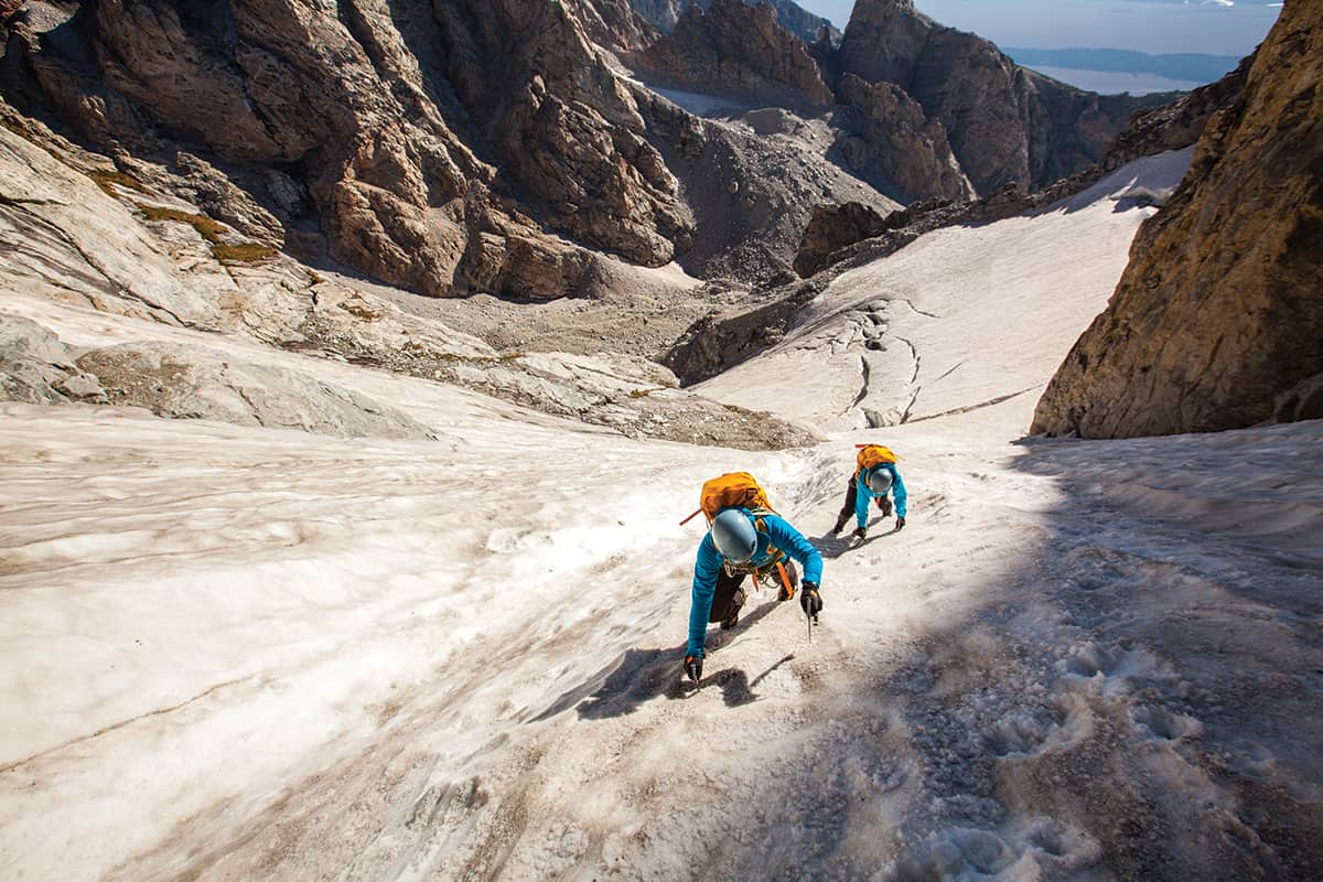
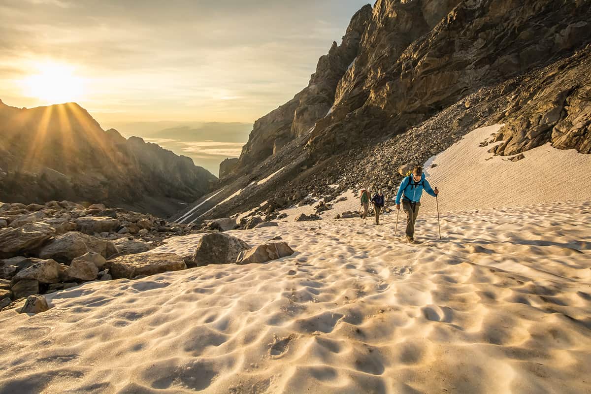
In 2015, before Caskey arrived, park staff worked to standardize its glacial research with help from people currently monitoring glaciers in the Rocky Mountains and North Cascades. Installed were temperature and solar radiation sensors, time-lapse cameras, aerial and ground photography capabilities, GPS surveys, discharge monitors, and radar imagery. To determine glacial activity, Caskey and his team now use GPS elevation surveys of the glacier’s surface combined with time-lapse photos. The former are not easy to accomplish, nor without risks. Crampons, ice axes, ropes, helmets, and mountain-savvy rangers are just the beginning of GPS work.
What do glaciers and Snickers have in common?
The visuals of the movement of a glacier have been likened to a Snickers—yes, the candy bar—bent into a U shape so it’s flat on the bottom and steep on the sides. As a Snickers bends, the chocolate part develops cracks just as glaciers develop crevasses. Continuing the analogy, the consistent flow of glacial ice is like the caramel, and debris picked up and carried by the ice can be compared to the Snickers’ peanuts.
Because of the specialized skills and experience GPS elevation surveys require, the glacial monitoring team relies on two to four Jenny Lake Climbing Rangers, the park’s elite rescue squad. The climbing rangers traverse the steep ice of the Middle Teton Glacier with six-foot-long rods and GPS units to collect data on the surface of the ice, Caskey explains. They spend several days a year, usually during the first week of September when most of the summer melt has happened but new snow has yet to fall, collecting the data Caskey and his team need. Humping packs that weigh between thirty and fifty pounds, they hike up to the Lower Saddle, at an elevation of almost 12,000 feet, and establish a camp for several days.
As dangerous and difficult as it is to conduct field studies on GTNP’s glaciers, Caskey and his team have it relatively easy. “Our monitoring is unique in the sense that we have very steep glaciers but they’re also relatively small and accessible,” Caskey says. How steep are GTNP’s glaciers? He compares the pitch of glaciers in the Wind River Range to green ski runs, while those in the Tetons are black diamonds. However, Caskey says, “We can go [monitor glaciers] without having to take a helicopter or walk twenty-five miles, [as researchers] in other glaciated ranges [must].”
Through this research and time-lapse photographs, sophisticated computer programs, time in the field, and mapping software, Caskey and his team seek to determine the volume loss of each glacier in the park. “We can say they are shrinking,” he says.
But that doesn’t mean they will disappear entirely. Some research indicates that as the glaciers recede in volume, they nestle against more protected landscapes—alpine cirques deep in shadows. These geographic protection points can positively affect the glacier’s lifespan. Some glaciers are more exposed to the sun. Because of these factors, Caskey says, extrapolating data to determine a glacier’s lifespan is “not linear.” There are too many variables scientists cannot predict, and how the geography will or will not protect the ice is just one of them. Another is how weather patterns might change.
STARTING IN 2013, GTNP began to release an annual “Vital Signs Summary.” The document analyzes four categories of park resources—climate and environment, cultural resources, natural resources, and challenges—to provide baseline data from which the park can determine whether things are trending toward “protection for future generations” as dictated by the Organic Act of 1916, which created the NPS (these reports may be found at nps.gov/grte/learn/nature/vital-signs.htm). The report includes glaciers as a resource indicator for climate and environment. Since 2015 it has classified GTNP’s glaciers as in “long-term decline.”
Caskey is by no means the first person to study GTNP’s glaciers. As far back as 1878, artists with the Hayden Survey noted a glacier in their drawings of the Teton Range. In 1926, three years before GTNP was founded, Fritiof Fryxell, who earned a Ph.D. in geology from the University of Chicago and wrote his dissertation on mountain glaciation, noted “at least seven” glaciers on Mount Moran and the Grand, Middle, and South Tetons. He described them as being on the east faces of the jagged peaks, above 10,000 feet in elevation. (Fryxell went on to be GTNP’s first naturalist, serving in that position from the park’s founding in 1929 until 1935.)
In the 1940s and ’50s other researchers looked at the park’s glaciers but none published his findings. In the 1960s, a researcher hammered metal stakes into the toe of the Teton Glacier, then returned the next year. Because the stakes he had placed the year before were no longer in the ice, he estimated the glacier lad lost about 1.5 feet in depth. Today, Caskey’s research has been boosted by funding from the Grand Teton National Park Foundation, which has given about $45,000 for glacier research over several years.
Recreationalists LIKE DRAMIS are not the only individuals to notice the change in the park’s glaciers. Forrest McCarthy has spent a lot of time in the Tetons as a climber and guide and is now working on his Ph.D. in glacial research. “I first stepped on the Teton Glacier in probably 1991,” he says. “In those days you could pretty much step off the terminal moraine and onto glacier ice. Now it’s thinning. It’s obvious. The toe of the glacier is upstream of the moraine. It’s receded and thinned, significantly.”
When glaciers recede, it’s “not pretty,” says McCarthy. Sharp, steep rock is exposed. This makes once-accessible climbing routes, with approaches over glaciers, more difficult. Glacial recession “has changed climbing in the Tetons,” he says. “It’s made classic alpine climbs harder, less accessible, and not as interesting.” Some climbing routes, like Black Ice Couloir, are nearly gone, he says. Other routes are becoming more dangerous. The loss of glaciers also makes the park “a little less scenic,” McCarthy says. “People driving through the park won’t see them. The Teton Glacier Turnout will become something of the past.”
Shrinking glaciers in GTNP don’t affect only sightseeing and climbing. Without glacial ice to melt in the late summer, some fisheries and aquatic environments could dry out. Studies done in areas of the Wind Rivers similar to the Tetons reveal some of these environments get as much as 12 percent of their runoff from late-season glacial melt. People who rely on later-season water for irrigation or recreation will be pinched, as well. Fish relying on late-season streams connecting alpine lakes could find their spawning and migrations interrupted, or impossible. There’s a species of stonefly, a food source important to trout, that lives within a hundred yards of glaciers’ terminuses. These insects could disappear, which would also affect trout populations. Without as much glacial melt feeding into them, the water in creeks and streams will be warmer, which can affect fish migration and give rise to algae blooms. And the park’s spectacular late-season wildflowers rely, in part, on glacial meltwater.
One of the reasons Caskey is passionate about glaciers—and glacial research—in the Tetons is because these mountains are some of the only places in the Rocky Mountains where you can see glaciers from the car. “It’s such a great outreach component to tell and show people this is an amazing geologic feature we can see the evidence of all around us,” he says. “It’s potentially leaving us at a faster rate because of the decisions we are making on a day-to-day basis.”
Maybe, he says, people will change some behaviors when they have a tangible vision for impacts. “I really do think these are powerful landscapes from a science perspective but also an educational perspective. They mean a lot to me from that standpoint. It’s sort of sad but it also gives us an opportunity to convey a message.”
Glaciers in the wild
How do you know if you’re looking at one of the park’s eleven glaciers, or just at a snowfield? That’s tricky. In winter, of course, you can’t tell one from the other. But in the summer, glaciers tend to be dirtier, and gray or bluish in color.
Visiting the Teton Glacier Turnout is one way to know you are looking at a glacier (the Teton Glacier is in the cirque below the Grand). And on Mount Moran, the Skillet Glacier is prominent as it faces northeast over Jackson Lake. The Middle Teton Glacier sits at the top of Garnet Canyon and is one of the most surveyed glaciers in the park because of its relatively easy access. (Also, it’s less steep and less dangerous than the park’s other glaciers, which allows researchers to spend more time on it.) Rays of sun refracting off the glacial silt, or finely ground rock, from Petersen Glacier, near the top of the North Fork of Cascade Canyon, turns Mica Lake its signature turquoise blue. Nearby Lake Solitude is not glacier-fed and is therefore the more typical high-mountain blue.
If you get up close to a glacier—something few people do—you’ll see that it pulls away from nearby rock walls, forming a gap between rock and ice. This is called a bergschrund. Snowfields don’t have bergschrunds. Glaciers also have crevasses—deep fissures or cracks in the ice—that are evidence of ice moving.