Read The
Current Issue
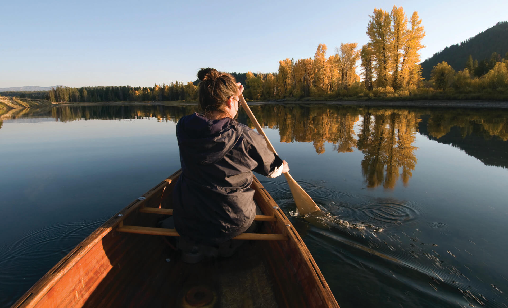
The Snake River
This river has multiple personalities asit winds through Jackson Hole.
// By samantha simma
// Photography by bradly j. boner
The source of the Snake River is in the wildlands of the Greater Yellowstone Ecosystem—at about 8,200 feet on Two Ocean Plateau in the Teton Wilderness of the Bridger-Teton National Forest. From this remote area, the mighty river—the largest tributary of the Columbia River—flows into Yellowstone and Grand Teton National Parks, the John D. Rockefeller Memorial Parkway, and then back into the BTNF before leaving Jackson Hole at the town of Alpine, Wyoming. It enters the valley at Jackson Lake, where it is briefly impounded by Jackson Lake Dam. From the dam, it winds its way through Jackson Hole for about 80 miles, until it hits Palisade Reservoir at Alpine. After another brief stop here, it continues its journey to Washington State, where it joins the Columbia River.
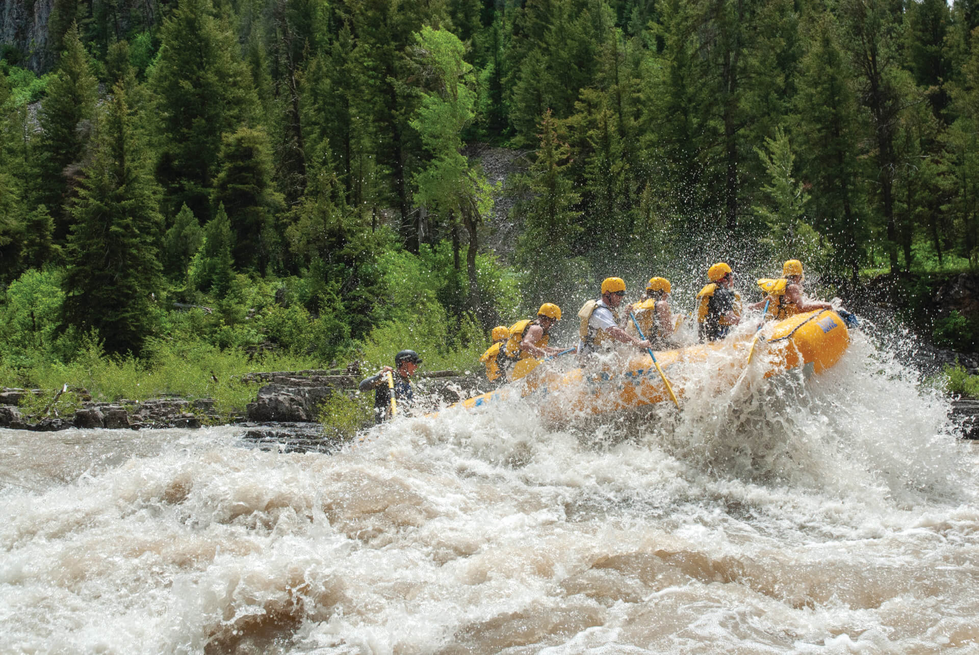
In 2009, 390 miles of the Snake and its tributary creeks in and around Jackson Hole were designated as Wild and Scenic. Different sections received this designation for different reasons, including free-flowing condition; high water quality; exceptional scenery or fishery; or remarkable wildlife, recreational, geological, and cultural resources. It is partly because of these different attributes that the Snake River through Jackson Hole has many different personalities. There are flatwater and Class III whitewater rapids. The river winds beneath mountains and also through riparian areas and pastoral ranchlands. Sometimes it’s corralled in a steep canyon; other times its banks are gentle. One thing that is always along it here, though, is wildlife—elk, mule deer, and bison frequent its banks, and bald eagles soar overhead, scanning the waters for their next meal.
1. Jackson Lake Dam to Pacific Creek is a five-mile float located entirely in Grand Teton National Park and one of the Wild and Scenic sections of the river. It offers calm waters, Teton views, and minimal obstructions, making it ideal for a relaxing river outing. National Park regulations include securing a nonmotorized boat permit, inspecting for aquatic invasive species (AIS), and ensuring inflatable boats (including SUPs) have three separate air chambers. Boaters should be mindful at Pacific Creek, where swift currents require careful scouting before takeout.
While recreating on waters in GTNP, all vessels must carry a personal flotation device (PFD) of the appropriate size for each person on board. Adult PFDs must be accessible and in good working condition; passengers under 13 years old must always wear a PFD.
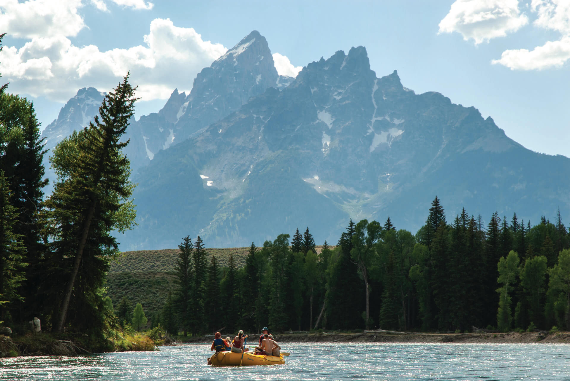
2. The 10-mile stretch of the Snake from Deadmans Bar to Moose Landing is another Wild and Scenic section and offers staggering Teton views. Although it is flatwater, it is the most challenging part of the Snake in GTNP, and we recommend you go on a guided float unless you’re a skilled river traveler. (If you book a Snake River float in GTNP; this is the stretch that all commercial operators do.) Marked by steep drops, an accelerated current, complex braiding, and constantly shifting logjams, this segment demands heightened awareness and skill.
River conditions fluctuate dramatically, but the technical challenges of this particular stretch make them more dynamic to changes in flow rates, which can be found posted regularly at river landings and permit offices. In spring and early summer, the river is cold, fast, and muddy, intensifying the difficulty. Later in the season, as snowmelt subsides, the water clears, and flow diminishes, yet the powerful current persists. Afternoon headwinds can further complicate navigation.
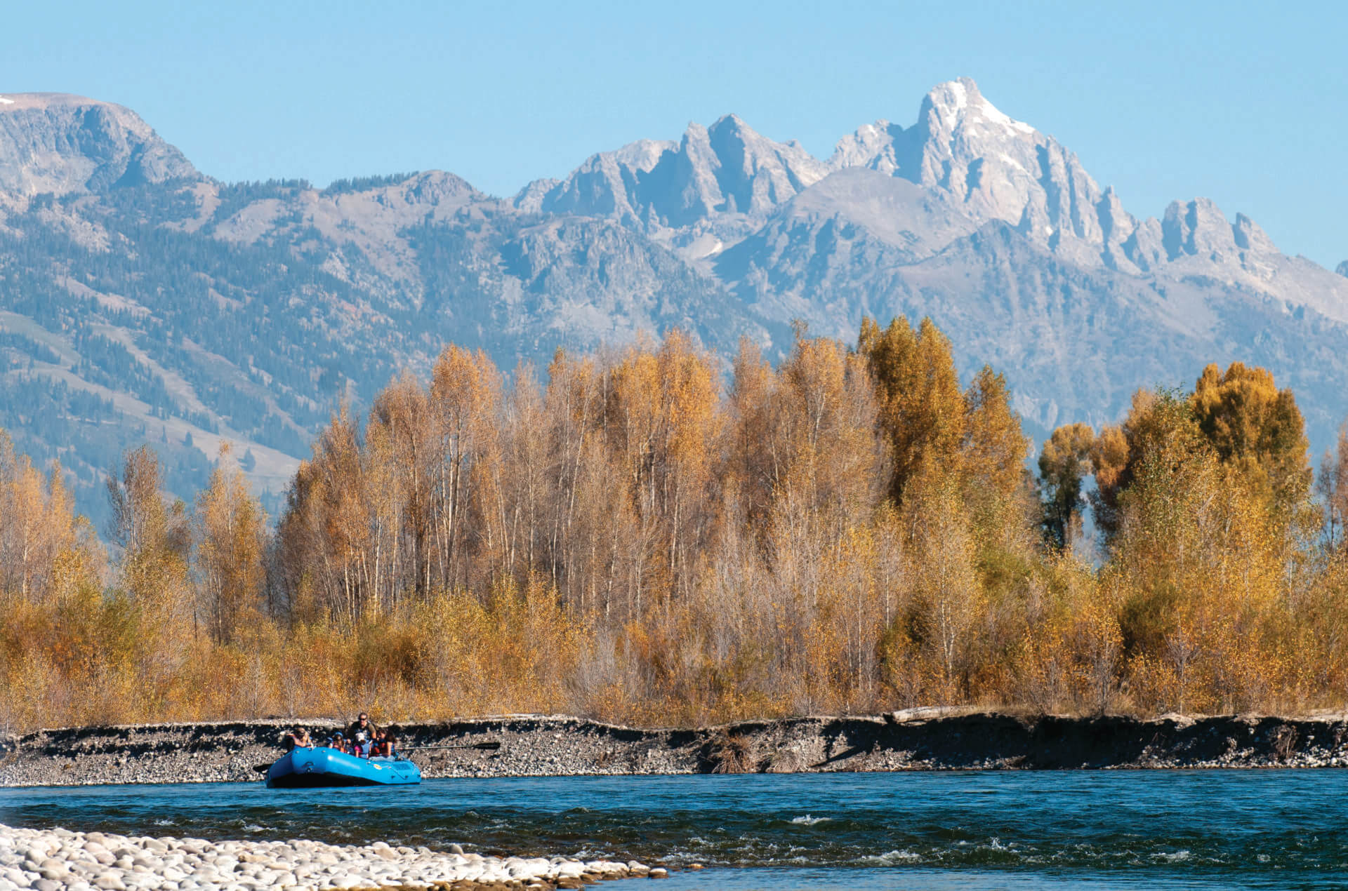
3. The 13-mile section of the Snake from Wilson Bridge to South Park is wholly outside of GTNP and winds its way largely through private property and segments of Bureau of Land Management land. A mellow, scenic float, it is the stretch of the Snake on which local tour operators do their scenic float trips. The Tetons aren’t as in-your-face on this float as on the Deadmans to Moose stretch, but wildlife enthusiasts will find much to admire—ospreys, perched on pines or circling above, are a common sight, while watchful observers may spot beavers tending to their dens near the water’s edge. Bald eagles frequently nest in the towering cottonwoods along the riverbank. The latter portion of this stretch passes the South Park wildlife management area, where deer, elk, and moose can often be seen grazing or seeking a drink from the river.
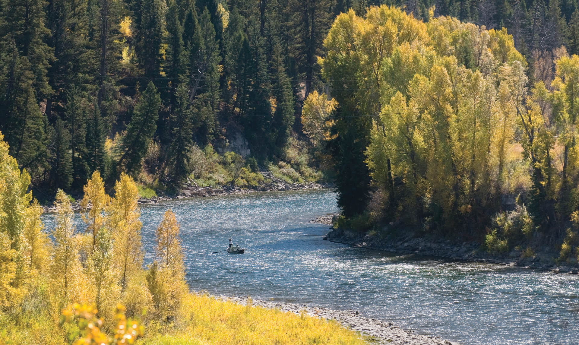
4. The South Park Landing to Pritchard stretch offers an accessible yet engaging 8.5-mile float, suitable for novice to intermediate boaters to do on their own. This section features a largely unobstructed channel and dynamic eddies, with King’s Wave providing a notable Class II whitewater feature about a mile downstream of the Hoback River confluence. Below this confluence, the river is again designated as Wild and Scenic.
During the height of summer, South Park Landing is one of the river’s most active boat ramps, requiring patience and courtesy among river users. To minimize disruptions, boaters are encouraged to prepare their crafts away from the ramp, stagger launches, and avoid playing loud music that could disturb both wildlife and fellow visitors.