Read The
Current Issue
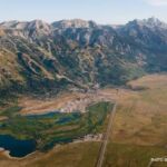
Sky Rim
Hiking in Yellowstone is more than meadows and geysers.
BY Maggie Theodora
PHOTOGRAPHY BY Derek stal
THE WORLD’S FIRST national park is full of geologic splendors. Yellowstone has bubbling mud pots. Technicolor springs. Geysers galore. Some of these splendors don’t even smell like rotten eggs. Yellowstone also has lots of wildlife—bison, wolves, elk, bears, and bald eagles. Upwards of nine hundred miles of trails wander through and past these sights. As wondrous as all of these things are, they don’t make for expansive views or exciting or dramatic hiking. (Not counting any drama arising from being chased by a bison or bear.)
Yellowstone hikes are pretty. Peaceful. Relaxing. Interesting. Used to getting smacked in the face by the outsized beauty of the Tetons, I’ve never stopped in the middle of a Yellowstone hike to pick my jaw up off the ground, though. (Not counting when I’ve been shocked and awed by humans behaving badly around wildlife.) Nor have I ever stopped in Yellowstone to take a 360-degree panoramic photo. Until last summer.
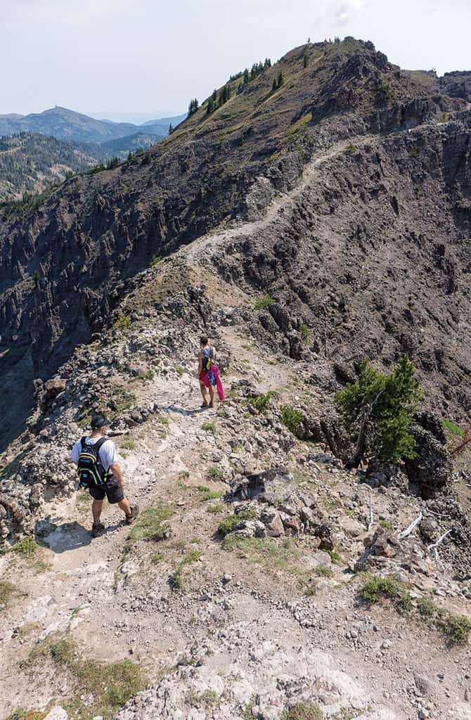
Seven miles of trail tucked into the northwestern part of the park follow a ridge that undulates between 8,500 and 9,500 feet. The 360-degree views you get from it stretch across the park and into three states. Not even counting the ten-minute detour to the 9,888-foot summit of Big Horn Peak via a trail carved out of the side of that mountain, your jaw will hit the ground several times over the course of hiking the Sky Rim Trail, which is unlike any other trail in Yellowstone. This could be because it is barely in Yellowstone.
BETWEEN DALY PASS and Big Horn Peak, the ridge portion of the trail—the entire trail is a twenty-mile lollipop with a “stick” of about two miles—is part of the northwestern boundary of Yellow-stone. According to Bill Schneider’s book, Hiking Montana, this area was the last bit of land added to the park, way back in 1927, bringing its total size to today’s 2,221,766 acres. Walking the ridge, at regular intervals you pass metal survey stakes delineating the park’s boundary. The trail is 99 percent on the Yellowstone side. Once or twice you might dip out of the park and into the Gallatin National Forest.
Twenty miles that include about five thousand vertical feet of climbing is a long hike. Fit hikers can do the Sky Rim in a day. Not-so-fit hikers should seriously consider getting fitter before doing it even over a couple of days. Doing it as a two-day trip overnight, the best place to camp is Shelf Lake, three miles off the trail and thirteen miles from the start. So even the “easy” option requires a really long Day 1. Outfitters sometimes do it over four or five days.
Short on time and long on fitness, just after dawn one morning late last August, our group of three left the Daly Creek trailhead, nearly thirty miles north of West Yellowstone, Montana, off US 191, armed only with daypacks. These were stuffed with extra liters of water because we read there was no water during the middle twelve miles of the trek.
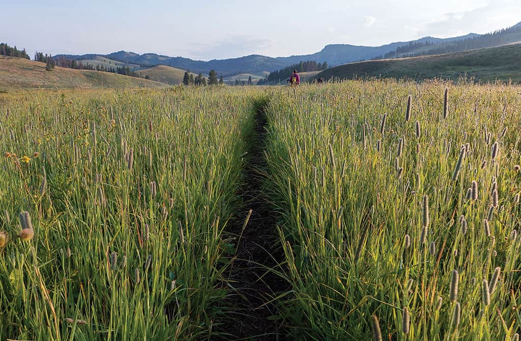
WITHIN A MILE of leaving the parking lot, my lower half was dripping wet. This was not because my CamelBak had leaked, but because, at its beginning and end, the trail travels through usual Yellowstone terrain: grassy meadows. On this particular morning, the waist-high grasses dripped with dew. My shorts were quickly soaked through. My shoes squelched with every step. I won’t lie—it was fairly miserable, especially since temperatures were fairly chilly. Late August mornings can dip into the 30s. An hour passed during which I could not feel my hands. Even though picturesque meadows are a dime a dozen in Yellowstone, had my fingers not been frozen, I would have taken many photos of this meadow. Bisected by Daly Creek and with Crown Butte looming above to the west, it is particularly picturesque.
Accustomed to hiking in the Tetons, as we made our way up Daly Pass through pine trees, I wondered why Hiking Montana’s Schneider had graded the climb up this pass as a Category 1—most difficult. He wrote about it and the ridge that follows: “It seems you should be about as high up as you can get, but you aren’t even close to the top.” He had obviously never hiked to the summit of the South Teton, or anywhere in the Tetons.
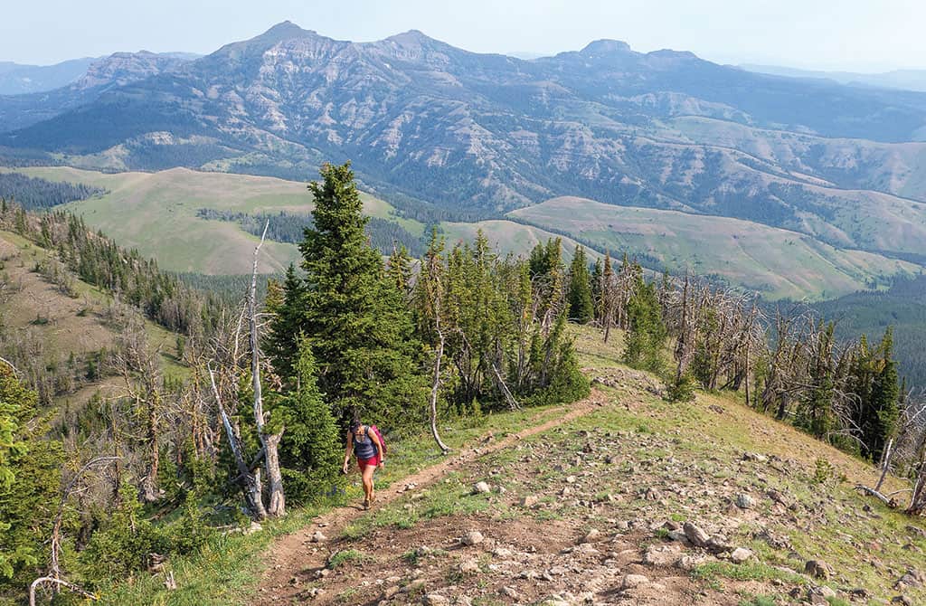
TRAVERSING THE RIDGE, I became less snarky. I counted the peaklets we walked up and down. I also lost count of the peaklets we went up and down. Six? Seven? Twelve? I do know it was exactly three more peaklets than my legs wanted. I enjoyed the 360-degree views. We saw the Gallatin Range. Also the Absarokas. Looking behind us to the north, we saw The Sphinx in the Madison Range and thought we recognized Big Sky Resort’s Lone Peak. I pondered whether I had ever had such expansive views anywhere in Yellowstone.
We could not see the Tetons. When we remembered to look at what was right in front of us, we saw weird volcanic formations, hunks of jet-black obsidian, and petrified tree trunks.
THE FINAL PEAKLET in the ridge was the toughest and its base had the coolest trees of the trip: long dead and denuded of their needles, their limbs wore a thick robe of lime green moss. Both to rest my legs before the final ascent and because I thought the trees quite fetching as subjects, I paused for a photo shoot.
And then I tackled the final climb. Not only was it the greatest vertical gain—five hundred feet—since the climb up Daly Pass, but, for extra fun, it was also steep and terribly loose. There was no sign of a trail anywhere, yet there was no doubting where we needed to go: up. Each of us went our own way. Derek smartly did mini-switchbacks. Larry channeled his inner tank, putting his head down and pointing straight up. I was somewhere in the middle, using the little vegetation specking the hillside to hop hummock-to-hummock. Going back again to Hiking Montana, Schneider writes that this section is “the most precipitous section of designated trail in the park, but it’s not dangerous.” I didn’t disagree so much with this assessment.
We could have stopped in the airplane-carrier-size grassy field at the top of this hillside—that’s what the official Sky Rim Trail does—but had been told the side trip (only one-third of a mile) to the summit of Big Horn Peak was very much worth the effort. Ten minutes later, on that comfortable summit, we marveled not only at the views back onto the entirety of the ridge we had just traveled, but also at the summit trail itself. Carved into the peak’s crumbly, cliffy side, it was a feat of engineering and execution.
From the summit of Big Horn Peak, it was all downhill. Literally and figuratively. Before disappearing into the dense forest, I turned around and gave the Sky Rim a wave goodbye. And then I reminded my muscles that even though my eyes could now rest, they still had ten miles of work to get to the car.
NUTS & BOLTS
There is no camping at the Daly Creek trailhead, which is off US 191 almost thirty miles north of West Yellowstone. The trailhead is on the north side of the road and is signed. The nearest lodging is in West Yellowstone. The drive from Jackson to West Yellowstone is about 125 miles. Camping at Shelf Lake requires a Yellowstone backcountry permit. The Shelf Lake campsites are WE5 and WE7. nps.gov/yell
This summer, Big Wild Adventures offers two guided backpacking trips in this area: July 13-17 and 19-24. The earlier trip is an easier itinerary and costs $1,750. The second trip is $1,900. Prices include usage of their gear. Bring your own and save $250. 406/848-7000; bigwildadventures.com
Experienced, fit hikers who want to do the Sky Rim in a day can arrange a custom trip with Yellowstone Hiking Guides. 406/848-1144; yellowstonehikingguides.com