Read The
Current Issue

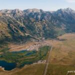
Jackson Hole’s Hidden Range
Starting in the southern part of the valley, the Snake River Mountains offer big terrain and quiet trails.
// Story and Photography By Dina Mishev
Two-thirds of the way through a hike to a little-known peak southwest of Jackson Hole, my husband and I stop to rest. At 8,800 feet on the mountain’s eastern flank, a stand of gnarled whitebark pines makes the perfect place to hang the lightweight hammocks we carry in our daypacks. As I settle in, a Clark’s nutcracker industriously works the cones overhead, lupine scents the breeze, and a red-tailed hawk briefly pierces the silence. The whole day has tracked like this.
We left the Little Elk Creek Trailhead six hours earlier. Since then, we’ve hiked seven miles, stood on one summit with views of at least five other mountain ranges, and spotted six mountain goats. We’ve also seen exactly two other people—and they were back in the parking lot. It’s a spectacular day in the Snake River Mountains, which isn’t unusual.
Overshadowed by the Tetons and the Gros Ventre Range, the Snake River Mountains—ancestral lands of several Native American tribes—straddle Wyoming and Idaho and span two national forests, the Bridger-Teton and Caribou-Targhee. Lacking in fame, they have their own appeal: uncrowded trails; high meadows bright with cow parsnip, penstemon, lupine, monkshood, and Western cornflower; wildlife including mountain goats, moose, elk, and bald and golden eagles; more than 100 miles of hiking and horseback trails; and the 130,000-acre Palisades Wilderness Study Area.
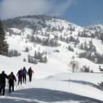
There’s motorized access, too. One of the valley’s few trail systems for dirt bikes and e-mountain bikes is here, though traditional mountain bikes—allowed on many hiking and horse trails—tend to gravitate toward Jackson Hole’s newer bike-specific routes rather than the Snake’s rougher terrain.
“The Snake River Mountains are just a spectacular range,” says Will Mook, executive director of the nonprofit Advocates for Multi-Use of Public Lands. “They don’t see nearly the use of the Tetons, but they’re just as rugged and beautiful.” Their beauty, though, is less obvious from the road.
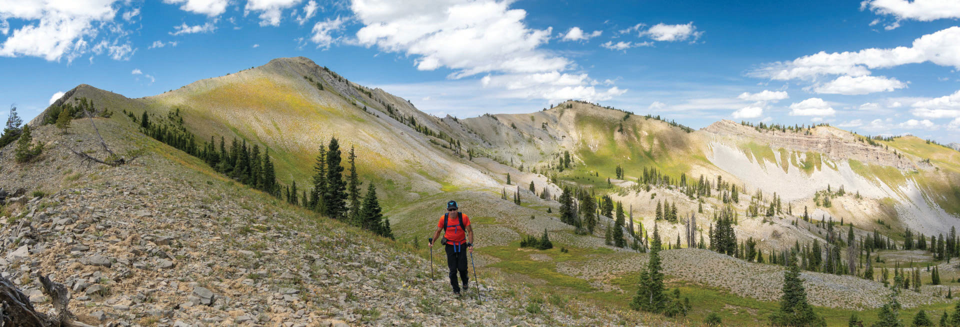
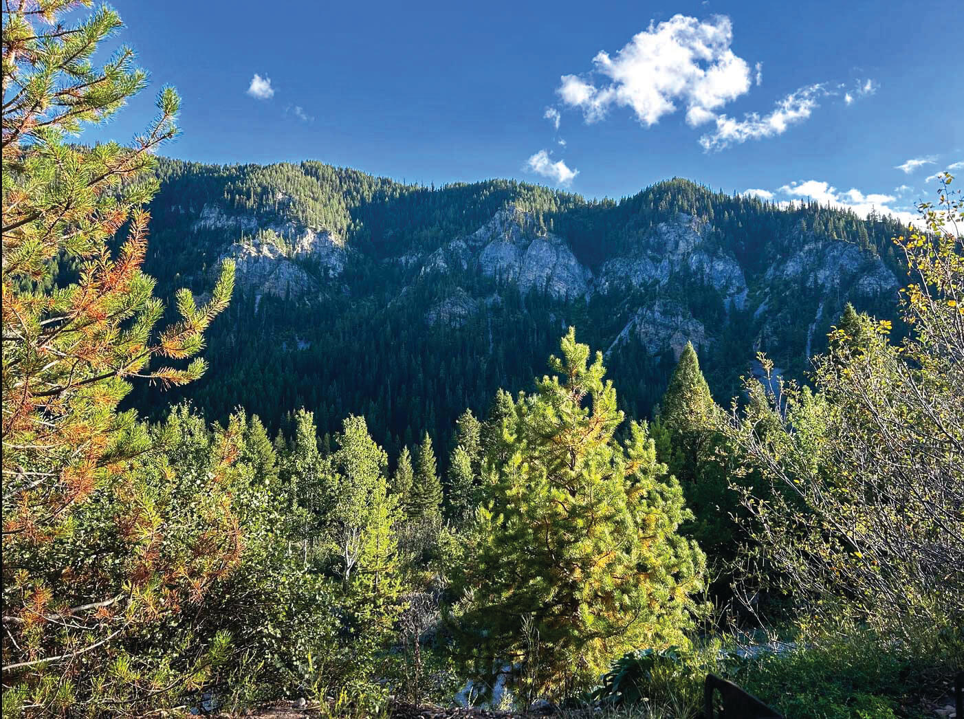
At the range’s northern end, near Teton Pass and above Fall Creek Road south of Wilson, the Snakes are more rolling hills than dramatic peaks. But the mountains grow steeper and more imposing as you head south, their faces of Madison limestone and Bighorn dolomite rising sharply above deep canyons. Only one summit breaks 10,000 feet—Mount Baird, at 10,030—but nearly 20 peaks top 9,000. “The Snakes have a lot packed into a small area,” says mountain guide, historian, and author Tom Turiano, whose book Select Peaks of Greater Yellowstone: A Mountaineering History and Guide includes descriptions of four peaks in the range.
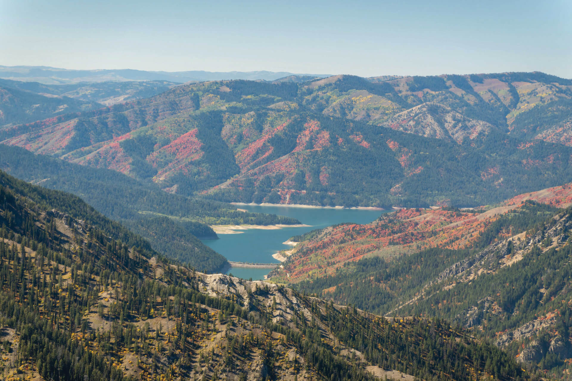
Part of the range’s appeal lies in its excess of wildflowers. Unlike nearby ranges, where grasses dominate meadows and nontreed hillsides, wildflowers here grow tall enough by mid-summer to obscure trails. Another part is its volatility. Steep V-shaped canyons are prone to landslides, and winter avalanches regularly uproot and rearrange entire stands of trees—nightmares for trail crews. But the chaos also shapes the landscape: Upper Palisades Lake, a striking patchwork of turquoise and emerald water, exists in part because of a landslide.
And then there’s the sense of remoteness. One of the largest roadless areas within the 20-million-acre Greater Yellowstone Ecosystem lies in the Snakes. Yet it’s also possible to be just three miles from a trailhead and feel astonishingly far from civilization—like a certain writer napping in a hammock on the side of Sheep Creek Peak.
Below are a few ways to explore the range. But first, a warning: because the Snakes see relatively little use—and because heavy storms can erase sections of trail—maps don’t always reflect reality. “Half of the ‘trails’ in the Snakes, there is no trail,” says a Forest Service trail crew member. “I’ve cut a trail one summer and come back the next year, and it’s totally gone.”
The hikes and horseback rides recommended here follow maintained trails. If you venture farther afield, bring a topo map—or call the Bridger-Teton (307/739-5400) or Caribou-Targhee (208/523-1412) ranger district for current conditions.
Hikes for Humans and Horses
Easy
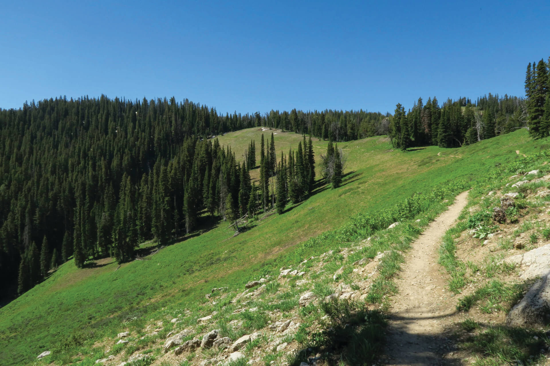
It’s a toss-up what’s more surprising on the gently climbing trail to Mt. Elly, on the south side of Teton Pass: the wildflowers lining the path or the mountain bikers riding past in full body armor. Some of the valley’s most technical downhill routes drop from here.
Mt. Elly sits at the northern end of the Snake River Mountains in the Bridger-Teton National Forest and is one of the easiest hikes in the area with views of nearly every mountain range surrounding Jackson Hole. The steepest section comes in the first quarter mile from the parking lot. From the east end, a singletrack trail climbs south toward the summit. From the west end, a dirt service road heads the same direction but climbs more gradually—less scenic, but easier.
This trail is popular with mountain bikers. The rule is that mountain bikers yield to hikers on trails, but if you want to earn hiking karma points, it is usually easier for hikers to step off the trail than for mountain bikers to do the same.
Start: The trailhead is at the top of Teton Pass.
Details: Four miles round-trip with 800 feet of vertical gain.
Medium
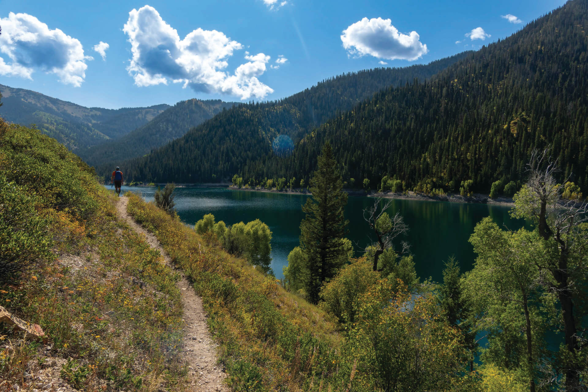
Even without any lakes, the first two miles of the Palisades Creek Trail—winding through a narrow rock-walled canyon—would be worth the trip. But the lakes are the real draw.
Lower Palisades Lake lies about four miles from the trailhead and only 500 vertical feet higher. The switchbacks are so gentle you often don’t notice the climb. Continue around the far end of the lake, and you’ll reach willow-filled wetlands where moose are sometimes spotted. Upper Palisades Lake sits nearly three miles farther. Beyond the lower lake, the trail climbs gradually above Palisades Creek before dropping back to the canyon floor at the junction with Dry Creek. From there, it climbs about 600 feet to the upper lake, which sits in a dramatic alpine basin at roughly 7,200 feet. Nearly 300 feet deep in places, Upper Palisades glows emerald and turquoise beneath snaggled peaks.
Start: Palisades Trailhead in Caribou-Targhee National Forest at the end of Palisades Creek Road, off Highway 26 between Irwin, Idaho, and the north end of Palisades Reservoir (about 75 minutes from Jackson).
Details: It’s 8.5 miles round-trip to Lower Palisades Lake; 14 miles to Upper Palisades Lake. About 500 feet or 1,700 feet of gain respectively. Widely considered the best horseback ride in the forest.
Hard
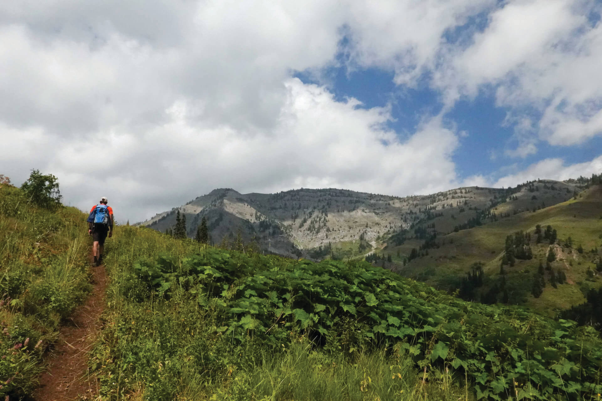
The North–South Fork Indian Creek Loop is classic Snake River Range terrain: stretches of great trail, sections hidden by wildflowers, a creek ford, big views, and very few people. Trail signs may be on posts, on the ground, or missing entirely—so bring a topo map.
From the North Fork Indian Creek Trailhead, you’ll ford the creek within the first mile. Continue upstream—stopping to snack on wild raspberries along the way—until you reach the Lake Basin Trail. Climb about 1,500 feet to the headwaters of the North Fork.
At the junction near the top, head toward Big Basin. The broad alpine valley lives up to its name; expect it to take at least an hour to cross to the far side. From there the trail climbs onto a ridge thousands of feet above the South Fork of Indian Creek before descending to the South Fork trailhead.
The two trailheads are close but not the same—about two miles apart on dirt roads—so leave a shuttle car or a bike if you want to avoid extra walking.
Start: North and South Fork Indian Creek trailheads in Caribou-Targhee National Forest off Indian Creek Road, from Highway 26 between Swan Valley and Alpine.
Details: About 20 miles with roughly 5,500 feet of ascent/descent. A demanding hike or horseback ride with steep, loose sections.
Sleep in the Snakes
Best for hikers and anglers:
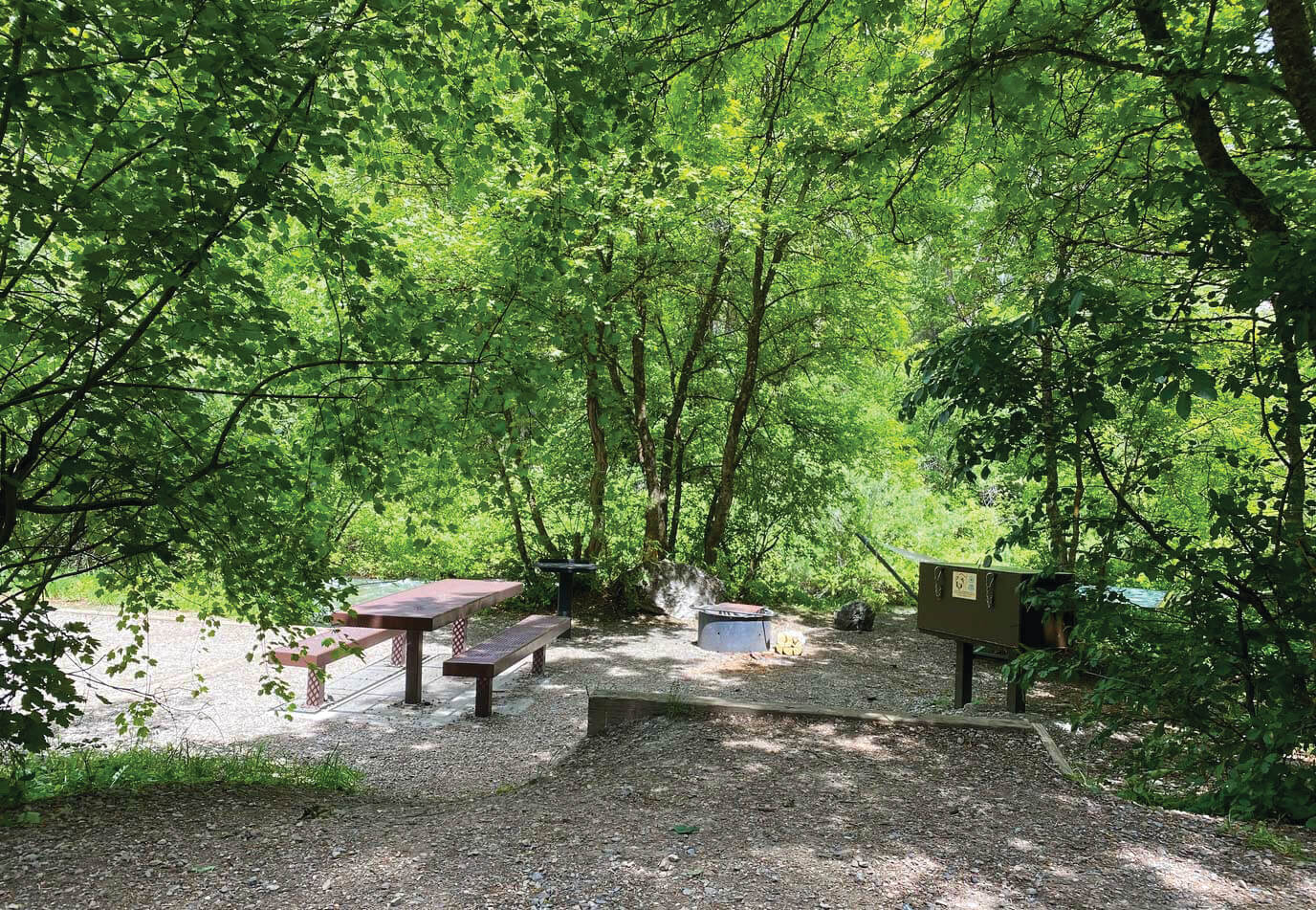
The first-come, first-served Palisades Creek Campground in Caribou-Targhee National Forest sits near the trailhead for Lower and Upper Palisades Lakes. Set along Palisades Creek—open to fishing starting July 1—this 5,900-square-foot campground has five single-family sites and two double sites, each with a picnic table and fire ring. Vault toilets are available, and drinking water is provided during the season. $17 single site, $34 double site
Best for views of the Snake River:
Bridger-Teton National Forest’s Wolf Creek Campground is the largest in the Snake River Canyon, with 20 sites perched on a hillside above the river. Each site includes a fire ring, picnic table, and food-storage locker. Vault toilets available. $20 per site
Best for motorized users:
The Mosquito Creek Dispersed Camping Area sits near the Mosquito Creek Motorized Area in Bridger-Teton National Forest. About 10 primitive sites lie off Forest Service Road 30980. No facilities. Park and camp only on previously hardened surfaces. Free
All sites accommodate tents, RVs, and trailers unless noted. Camping is limited to 14 days within any 30-day period. After 14 days, campers must move at least five air miles away and cannot return to the same site for 30 days.
A Snake Circumnavigation
Around the Block
Circumnavigate the Snake River Range by car, motorcycle, or road bike on a 106-mile loop known by the local cycling community as “Around the Block.” It can be done in either direction, but cyclists starting in Jackson or Wilson often go counterclockwise, tackling the two biggest climbs—Teton Pass and Pine Creek Pass—early.
From Jackson, take Highway 22 to Wilson, climb Teton Pass, and descend into Teton Valley, Idaho. In the town of Victor (mile 25), at Teton Valley’s sole stoplight, rest and refuel at Victor Valley Market before turning left on Idaho Highway 31. Follow it over Pine Creek Pass and down to Swan Valley (mile 45), where the road ends at U.S. Highway 26 and the Rainey Creek Store sells hand-dipped ice cream.
Turn left on Highway 26 and continue past farmland and Palisades Reservoir to Alpine, Wyoming (mile 75). Turn left again on U.S. Highway 89 and follow the Snake River Canyon back toward Jackson. For a celebratory meal, stop at The Bird south of town or Streetfood in Wilson. Cyclists can pick up a nonmotorized pathway at Hoback Junction that leads to Jackson and Wilson.
Driving time: 2–3 hours
Cycling time: 6–10 hours
Note: Much of the route lacks a shoulder.
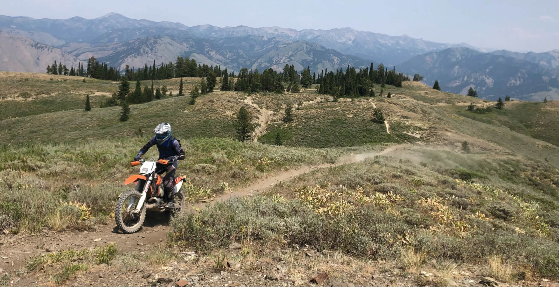
Dirt Biking in the Snakes
“The trails in the Snakes are generally on the easy side and are short, but they have great view opportunities and are a great place to progress if you’re just getting into the sport,” says AMPL’s Mook. “I learned how to shift a dirt bike in Mosquito Creek.”
Four miles south of Wilson, the Mosquito Creek Motorized Area includes about 12 miles of trails for dirt biking and e-mountain bikes. “We’re incredibly appreciative that we’ve been able to collaborate with the Forest Service to help build and maintain these trails,” Mook says. “It’s a really fun area, and for folks looking to do an hour after work, it scratches the itch.” AMPL recently developed and built the Kickstart trail here. A mellow one-mile loop, it’s designed for kids riding 50cc bikes to practice their skills. “The entire loop is within eyesight of the trailhead,” Mook says. Benches at the start are a good spot to speectate from.
About five miles farther south on Fall Creek Road, the Munger Mountain Recreation Area has 17 miles of singletrack trails open to dirt bikes and e-mountain bikes between July 1 and September 9.
A Snapshot of the Snakes
26 Trailheads
54 Named peaks
.13 Number of other people you can expect to run into in an hour
40 million Acres, including the Snake River Range, promised to the Shoshone in an 1863 treaty
296 Number of trees cleared from trails in the range in 2024
53 Percentage of users that ride horsesNumber of trees cleared from trails in the range in 2024
105 Miles of Trails
10,030′ Elevation of Mt. Baird, the highest peak in the range
130,000 Acres in the PalisadesWilderness Study Area
1873 First year a map included the name “Snake River Range”
46 Percentage of users that are hikers15
15 Miles of dirt-biking trails at Mosquito Creek JH